You are here: Home > Network List > TA - USArray Transportable Network (new EarthScope stations) Stations List
> Station P20A De Beque, CO, USA > Earthquake Result Viewer
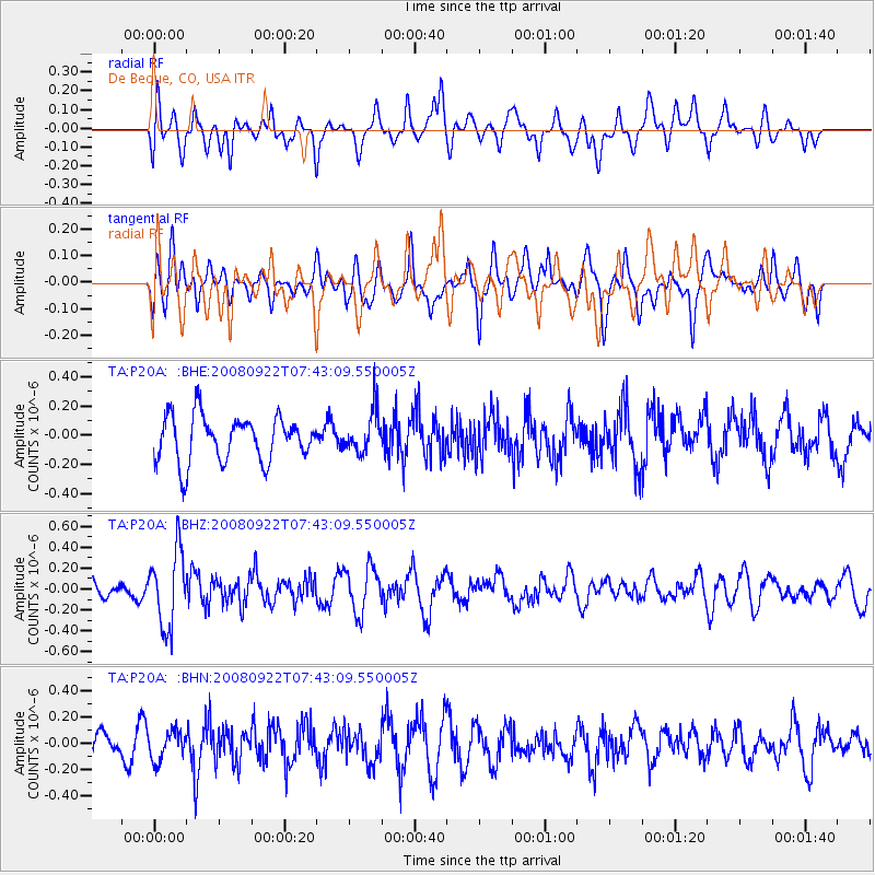
P20A De Beque, CO, USA - Earthquake Result Viewer
*The percent match for this event was below the threshold and hence no stack was calculated.
| Earthquake location: |
Hokkaido, Japan Region |
| Earthquake latitude/longitude: |
41.6/140.4 |
| Earthquake time(UTC): |
2008/09/22 (266) 07:31:59 GMT |
| Earthquake Depth: |
149 km |
| Earthquake Magnitude: |
5.7 MW, 5.3 MB, 5.6 MW |
| Earthquake Catalog/Contributor: |
WHDF/NEIC |
|
| Network: |
TA USArray Transportable Network (new EarthScope stations) |
| Station: |
P20A De Beque, CO, USA |
| Lat/Lon: |
39.50 N/108.39 W |
| Elevation: |
1738 m |
|
| Distance: |
77.9 deg |
| Az: |
47.553 deg |
| Baz: |
314.313 deg |
| Ray Param: |
$rayparam |
*The percent match for this event was below the threshold and hence was not used in the summary stack. |
|
| Radial Match: |
56.20115 % |
| Radial Bump: |
400 |
| Transverse Match: |
42.494514 % |
| Transverse Bump: |
400 |
| SOD ConfigId: |
2560 |
| Insert Time: |
2010-03-06 07:21:01.238 +0000 |
| GWidth: |
2.5 |
| Max Bumps: |
400 |
| Tol: |
0.001 |
|
Signal To Noise
| Channel | StoN | STA | LTA |
| TA:P20A: :BHZ:20080922T07:43:09.550005Z | 3.7477307 | 3.5943086E-7 | 9.5906266E-8 |
| TA:P20A: :BHN:20080922T07:43:09.550005Z | 1.1704459 | 1.0905186E-7 | 9.317121E-8 |
| TA:P20A: :BHE:20080922T07:43:09.550005Z | 0.9175562 | 1.4241512E-7 | 1.5521131E-7 |
| Arrivals |
| Ps | |
| PpPs | |
| PsPs/PpSs | |


