You are here: Home > Network List > TA - USArray Transportable Network (new EarthScope stations) Stations List
> Station C16K Lisburne Hills, AK, USA > Earthquake Result Viewer
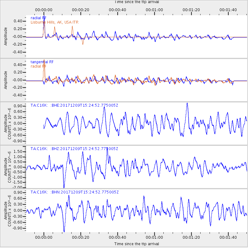
C16K Lisburne Hills, AK, USA - Earthquake Result Viewer
*The percent match for this event was below the threshold and hence no stack was calculated.
| Earthquake location: |
W. Caroline Islands, Micronesia |
| Earthquake latitude/longitude: |
10.1/140.2 |
| Earthquake time(UTC): |
2017/12/09 (343) 15:14:24 GMT |
| Earthquake Depth: |
10 km |
| Earthquake Magnitude: |
6.1 Mww |
| Earthquake Catalog/Contributor: |
NEIC PDE/us |
|
| Network: |
TA USArray Transportable Network (new EarthScope stations) |
| Station: |
C16K Lisburne Hills, AK, USA |
| Lat/Lon: |
68.27 N/165.34 W |
| Elevation: |
102 m |
|
| Distance: |
68.0 deg |
| Az: |
19.069 deg |
| Baz: |
239.784 deg |
| Ray Param: |
$rayparam |
*The percent match for this event was below the threshold and hence was not used in the summary stack. |
|
| Radial Match: |
69.9207 % |
| Radial Bump: |
400 |
| Transverse Match: |
57.281086 % |
| Transverse Bump: |
400 |
| SOD ConfigId: |
13570011 |
| Insert Time: |
2019-04-29 09:52:09.697 +0000 |
| GWidth: |
2.5 |
| Max Bumps: |
400 |
| Tol: |
0.001 |
|
Signal To Noise
| Channel | StoN | STA | LTA |
| TA:C16K: :BHZ:20171209T15:24:52.775005Z | 1.7328457 | 3.9378148E-7 | 2.2724556E-7 |
| TA:C16K: :BHN:20171209T15:24:52.775005Z | 0.6612141 | 1.2505998E-7 | 1.891369E-7 |
| TA:C16K: :BHE:20171209T15:24:52.775005Z | 1.6135454 | 4.206983E-7 | 2.6072914E-7 |
| Arrivals |
| Ps | |
| PpPs | |
| PsPs/PpSs | |


