You are here: Home > Network List > TA - USArray Transportable Network (new EarthScope stations) Stations List
> Station P20A De Beque, CO, USA > Earthquake Result Viewer
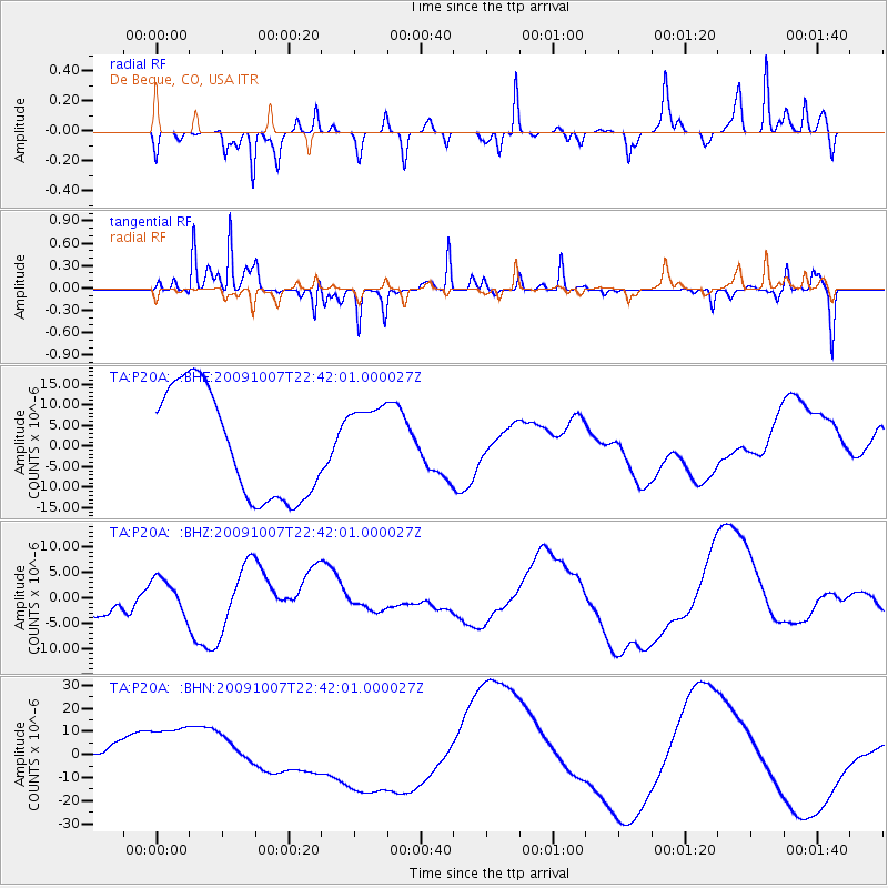
P20A De Beque, CO, USA - Earthquake Result Viewer
*The percent match for this event was below the threshold and hence no stack was calculated.
| Earthquake location: |
Santa Cruz Islands |
| Earthquake latitude/longitude: |
-11.5/166.0 |
| Earthquake time(UTC): |
2009/10/07 (280) 22:29:18 GMT |
| Earthquake Depth: |
35 km |
| Earthquake Magnitude: |
5.5 MB |
| Earthquake Catalog/Contributor: |
WHDF/NEIC |
|
| Network: |
TA USArray Transportable Network (new EarthScope stations) |
| Station: |
P20A De Beque, CO, USA |
| Lat/Lon: |
39.50 N/108.39 W |
| Elevation: |
1738 m |
|
| Distance: |
93.8 deg |
| Az: |
50.638 deg |
| Baz: |
258.365 deg |
| Ray Param: |
$rayparam |
*The percent match for this event was below the threshold and hence was not used in the summary stack. |
|
| Radial Match: |
44.98781 % |
| Radial Bump: |
266 |
| Transverse Match: |
81.74052 % |
| Transverse Bump: |
239 |
| SOD ConfigId: |
2622 |
| Insert Time: |
2010-03-06 07:21:24.723 +0000 |
| GWidth: |
2.5 |
| Max Bumps: |
400 |
| Tol: |
0.001 |
|
Signal To Noise
| Channel | StoN | STA | LTA |
| TA:P20A: :BHZ:20091007T22:42:01.000027Z | 0.54500675 | 3.155767E-6 | 5.7903267E-6 |
| TA:P20A: :BHN:20091007T22:42:01.000027Z | 3.6059735 | 1.4657976E-5 | 4.0649147E-6 |
| TA:P20A: :BHE:20091007T22:42:01.000027Z | 0.7022483 | 9.274224E-6 | 1.3206474E-5 |
| Arrivals |
| Ps | |
| PpPs | |
| PsPs/PpSs | |


