You are here: Home > Network List > US - United States National Seismic Network Stations List
> Station DGMT Dagmar, Montana, USA > Earthquake Result Viewer
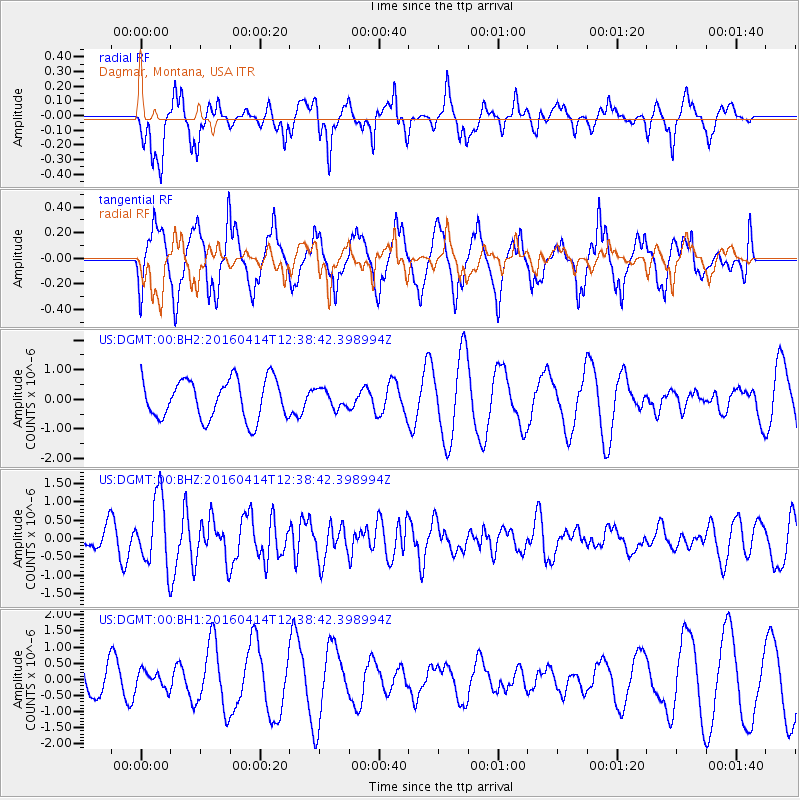
DGMT Dagmar, Montana, USA - Earthquake Result Viewer
*The percent match for this event was below the threshold and hence no stack was calculated.
| Earthquake location: |
Kyushu, Japan |
| Earthquake latitude/longitude: |
32.8/130.6 |
| Earthquake time(UTC): |
2016/04/14 (105) 12:26:36 GMT |
| Earthquake Depth: |
10 km |
| Earthquake Magnitude: |
6.2 MWW |
| Earthquake Catalog/Contributor: |
NEIC PDE/NEIC COMCAT |
|
| Network: |
US United States National Seismic Network |
| Station: |
DGMT Dagmar, Montana, USA |
| Lat/Lon: |
48.47 N/104.20 W |
| Elevation: |
0.0 m |
|
| Distance: |
85.4 deg |
| Az: |
33.077 deg |
| Baz: |
316.345 deg |
| Ray Param: |
$rayparam |
*The percent match for this event was below the threshold and hence was not used in the summary stack. |
|
| Radial Match: |
53.991665 % |
| Radial Bump: |
337 |
| Transverse Match: |
48.245106 % |
| Transverse Bump: |
332 |
| SOD ConfigId: |
1475611 |
| Insert Time: |
2016-04-28 12:37:57.307 +0000 |
| GWidth: |
2.5 |
| Max Bumps: |
400 |
| Tol: |
0.001 |
|
Signal To Noise
| Channel | StoN | STA | LTA |
| US:DGMT:00:BHZ:20160414T12:38:42.398994Z | 4.1018167 | 9.41273E-7 | 2.2947711E-7 |
| US:DGMT:00:BH1:20160414T12:38:42.398994Z | 0.7582109 | 2.6716836E-7 | 3.523668E-7 |
| US:DGMT:00:BH2:20160414T12:38:42.398994Z | 0.4736844 | 3.1455383E-7 | 6.6405784E-7 |
| Arrivals |
| Ps | |
| PpPs | |
| PsPs/PpSs | |


