You are here: Home > Network List > TA - USArray Transportable Network (new EarthScope stations) Stations List
> Station P20A De Beque, CO, USA > Earthquake Result Viewer
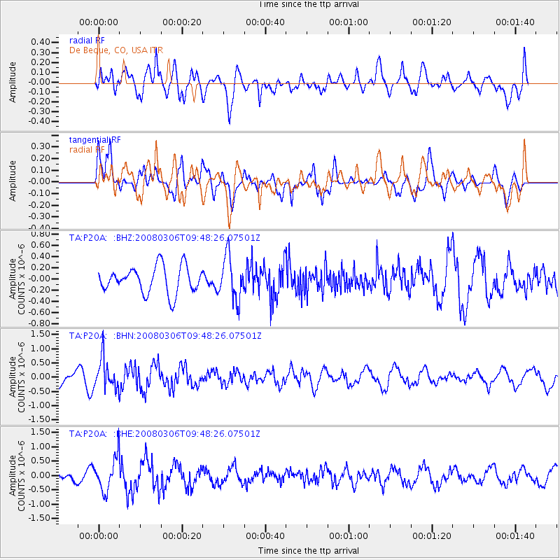
P20A De Beque, CO, USA - Earthquake Result Viewer
*The percent match for this event was below the threshold and hence no stack was calculated.
| Earthquake location: |
Kamchatka Peninsula, Russia |
| Earthquake latitude/longitude: |
51.5/156.5 |
| Earthquake time(UTC): |
2008/03/06 (066) 09:38:43 GMT |
| Earthquake Depth: |
134 km |
| Earthquake Magnitude: |
5.6 MB, 5.5 MW, 5.5 MW |
| Earthquake Catalog/Contributor: |
WHDF/NEIC |
|
| Network: |
TA USArray Transportable Network (new EarthScope stations) |
| Station: |
P20A De Beque, CO, USA |
| Lat/Lon: |
39.50 N/108.39 W |
| Elevation: |
1738 m |
|
| Distance: |
63.1 deg |
| Az: |
59.768 deg |
| Baz: |
315.759 deg |
| Ray Param: |
$rayparam |
*The percent match for this event was below the threshold and hence was not used in the summary stack. |
|
| Radial Match: |
69.438034 % |
| Radial Bump: |
400 |
| Transverse Match: |
71.75429 % |
| Transverse Bump: |
400 |
| SOD ConfigId: |
2504 |
| Insert Time: |
2010-03-06 07:22:25.941 +0000 |
| GWidth: |
2.5 |
| Max Bumps: |
400 |
| Tol: |
0.001 |
|
Signal To Noise
| Channel | StoN | STA | LTA |
| TA:P20A: :BHN:20080306T09:48:26.07501Z | 2.1308632 | 5.3479846E-7 | 2.509774E-7 |
| TA:P20A: :BHE:20080306T09:48:26.07501Z | 2.8253493 | 5.9284196E-7 | 2.0982961E-7 |
| TA:P20A: :BHZ:20080306T09:48:26.07501Z | 1.6597623 | 3.9549306E-7 | 2.3828295E-7 |
| Arrivals |
| Ps | |
| PpPs | |
| PsPs/PpSs | |


