You are here: Home > Network List > TA - USArray Transportable Network (new EarthScope stations) Stations List
> Station G21K Allakaket, AK, USA > Earthquake Result Viewer
G21K Allakaket, AK, USA - Earthquake Result Viewer
*The percent match for this event was below the threshold and hence no stack was calculated.
| Earthquake location: |
Vanuatu Islands |
| Earthquake latitude/longitude: |
-14.4/167.5 |
| Earthquake time(UTC): |
2017/12/11 (345) 17:29:10 GMT |
| Earthquake Depth: |
187 km |
| Earthquake Magnitude: |
5.6 Mww |
| Earthquake Catalog/Contributor: |
NEIC PDE/us |
|
| Network: |
TA USArray Transportable Network (new EarthScope stations) |
| Station: |
G21K Allakaket, AK, USA |
| Lat/Lon: |
66.52 N/153.51 W |
| Elevation: |
446 m |
|
| Distance: |
85.6 deg |
| Az: |
14.664 deg |
| Baz: |
217.75 deg |
| Ray Param: |
$rayparam |
*The percent match for this event was below the threshold and hence was not used in the summary stack. |
|
| Radial Match: |
71.26034 % |
| Radial Bump: |
400 |
| Transverse Match: |
58.881676 % |
| Transverse Bump: |
386 |
| SOD ConfigId: |
13570011 |
| Insert Time: |
2019-04-29 10:10:06.515 +0000 |
| GWidth: |
2.5 |
| Max Bumps: |
400 |
| Tol: |
0.001 |
|
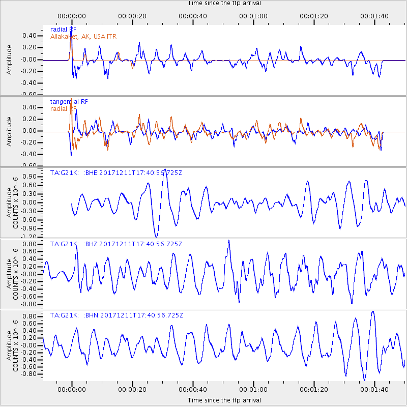
Signal To Noise
| Channel | StoN | STA | LTA |
| TA:G21K: :BHZ:20171211T17:40:56.725Z | 1.3737737 | 3.0329204E-7 | 2.2077293E-7 |
| TA:G21K: :BHN:20171211T17:40:56.725Z | 0.82043177 | 2.6899733E-7 | 3.2787287E-7 |
| TA:G21K: :BHE:20171211T17:40:56.725Z | 2.6587155 | 6.784809E-7 | 2.5519122E-7 |
| Arrivals |
| Ps | |
| PpPs | |
| PsPs/PpSs | |


