You are here: Home > Network List > TA - USArray Transportable Network (new EarthScope stations) Stations List
> Station L15K Ungalak Mountain, AK, USA > Earthquake Result Viewer
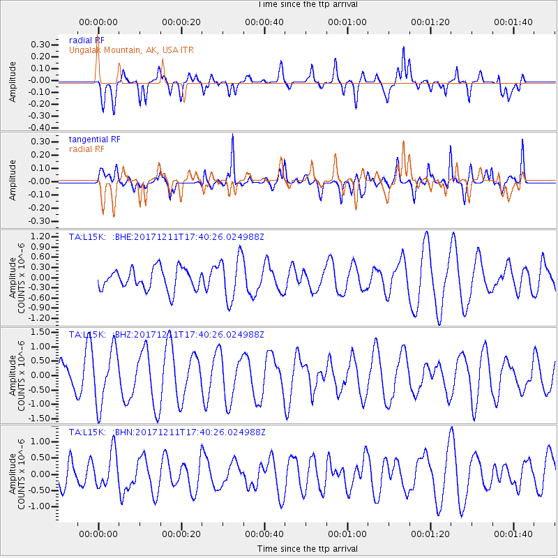
L15K Ungalak Mountain, AK, USA - Earthquake Result Viewer
*The percent match for this event was below the threshold and hence no stack was calculated.
| Earthquake location: |
Vanuatu Islands |
| Earthquake latitude/longitude: |
-14.4/167.5 |
| Earthquake time(UTC): |
2017/12/11 (345) 17:29:10 GMT |
| Earthquake Depth: |
187 km |
| Earthquake Magnitude: |
5.6 Mww |
| Earthquake Catalog/Contributor: |
NEIC PDE/us |
|
| Network: |
TA USArray Transportable Network (new EarthScope stations) |
| Station: |
L15K Ungalak Mountain, AK, USA |
| Lat/Lon: |
61.68 N/161.49 W |
| Elevation: |
219 m |
|
| Distance: |
79.7 deg |
| Az: |
14.483 deg |
| Baz: |
210.549 deg |
| Ray Param: |
$rayparam |
*The percent match for this event was below the threshold and hence was not used in the summary stack. |
|
| Radial Match: |
45.991142 % |
| Radial Bump: |
400 |
| Transverse Match: |
56.73397 % |
| Transverse Bump: |
400 |
| SOD ConfigId: |
13570011 |
| Insert Time: |
2019-04-29 10:10:14.254 +0000 |
| GWidth: |
2.5 |
| Max Bumps: |
400 |
| Tol: |
0.001 |
|
Signal To Noise
| Channel | StoN | STA | LTA |
| TA:L15K: :BHZ:20171211T17:40:26.024988Z | 2.481704 | 9.735561E-7 | 3.9229337E-7 |
| TA:L15K: :BHN:20171211T17:40:26.024988Z | 1.5817126 | 5.551084E-7 | 3.5095402E-7 |
| TA:L15K: :BHE:20171211T17:40:26.024988Z | 2.1394067 | 6.6220167E-7 | 3.0952586E-7 |
| Arrivals |
| Ps | |
| PpPs | |
| PsPs/PpSs | |


