You are here: Home > Network List > WY - Yellowstone Wyoming Seismic Network Stations List
> Station YHH Holmes Hill, YNP, WY, USA > Earthquake Result Viewer
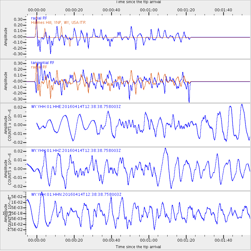
YHH Holmes Hill, YNP, WY, USA - Earthquake Result Viewer
*The percent match for this event was below the threshold and hence no stack was calculated.
| Earthquake location: |
Kyushu, Japan |
| Earthquake latitude/longitude: |
32.8/130.6 |
| Earthquake time(UTC): |
2016/04/14 (105) 12:26:36 GMT |
| Earthquake Depth: |
10 km |
| Earthquake Magnitude: |
6.2 MWW |
| Earthquake Catalog/Contributor: |
NEIC PDE/NEIC COMCAT |
|
| Network: |
WY Yellowstone Wyoming Seismic Network |
| Station: |
YHH Holmes Hill, YNP, WY, USA |
| Lat/Lon: |
44.79 N/110.85 W |
| Elevation: |
2717 m |
|
| Distance: |
84.7 deg |
| Az: |
38.933 deg |
| Baz: |
312.025 deg |
| Ray Param: |
$rayparam |
*The percent match for this event was below the threshold and hence was not used in the summary stack. |
|
| Radial Match: |
41.62675 % |
| Radial Bump: |
347 |
| Transverse Match: |
62.524433 % |
| Transverse Bump: |
400 |
| SOD ConfigId: |
1475611 |
| Insert Time: |
2016-04-28 12:40:59.835 +0000 |
| GWidth: |
2.5 |
| Max Bumps: |
400 |
| Tol: |
0.001 |
|
Signal To Noise
| Channel | StoN | STA | LTA |
| WY:YHH:01:HHZ:20160414T12:38:38.758003Z | 1.2888647 | 8.448056E-9 | 6.5546484E-9 |
| WY:YHH:01:HHN:20160414T12:38:38.758003Z | 1.8001355 | 1.19656285E-8 | 6.647071E-9 |
| WY:YHH:01:HHE:20160414T12:38:38.758003Z | 0.8108931 | 6.1225705E-9 | 7.550404E-9 |
| Arrivals |
| Ps | |
| PpPs | |
| PsPs/PpSs | |


