You are here: Home > Network List > TA - USArray Transportable Network (new EarthScope stations) Stations List
> Station I17K Unalakleet, AK, USA > Earthquake Result Viewer
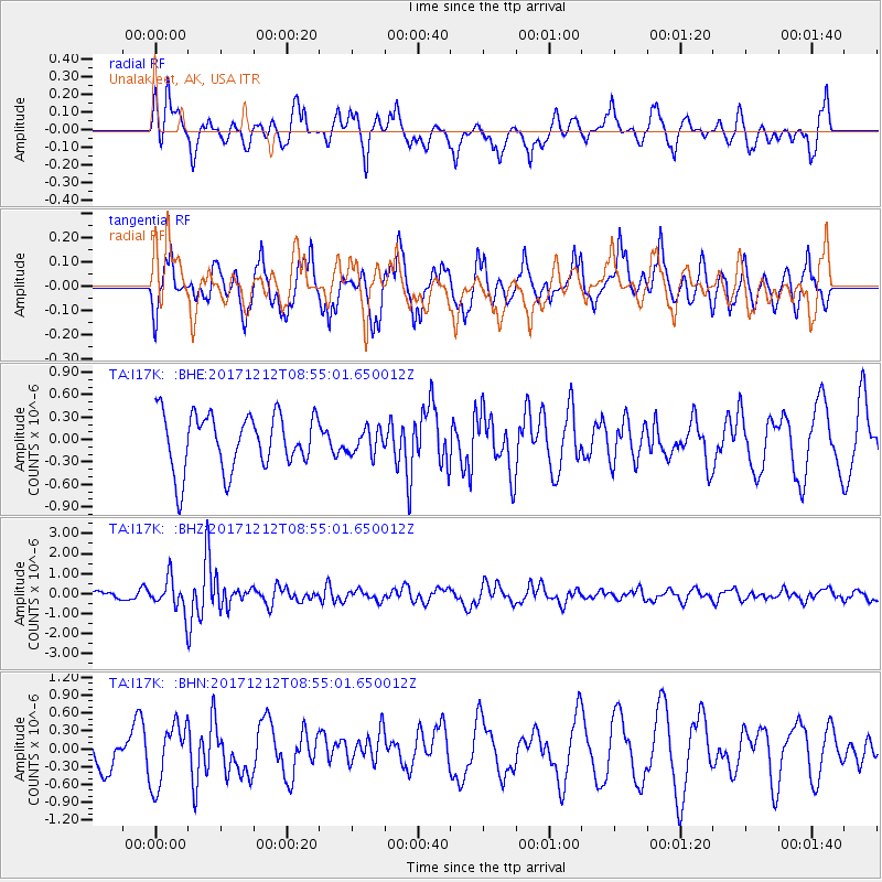
I17K Unalakleet, AK, USA - Earthquake Result Viewer
*The percent match for this event was below the threshold and hence no stack was calculated.
| Earthquake location: |
Northern And Central Iran |
| Earthquake latitude/longitude: |
30.7/57.3 |
| Earthquake time(UTC): |
2017/12/12 (346) 08:43:17 GMT |
| Earthquake Depth: |
10 km |
| Earthquake Magnitude: |
6.0 Mww |
| Earthquake Catalog/Contributor: |
NEIC PDE/us |
|
| Network: |
TA USArray Transportable Network (new EarthScope stations) |
| Station: |
I17K Unalakleet, AK, USA |
| Lat/Lon: |
63.89 N/160.70 W |
| Elevation: |
105 m |
|
| Distance: |
81.1 deg |
| Az: |
15.997 deg |
| Baz: |
327.568 deg |
| Ray Param: |
$rayparam |
*The percent match for this event was below the threshold and hence was not used in the summary stack. |
|
| Radial Match: |
59.89951 % |
| Radial Bump: |
400 |
| Transverse Match: |
63.124905 % |
| Transverse Bump: |
400 |
| SOD ConfigId: |
13570011 |
| Insert Time: |
2019-04-29 10:23:06.508 +0000 |
| GWidth: |
2.5 |
| Max Bumps: |
400 |
| Tol: |
0.001 |
|
Signal To Noise
| Channel | StoN | STA | LTA |
| TA:I17K: :BHZ:20171212T08:55:01.650012Z | 2.557832 | 8.03974E-7 | 3.1431853E-7 |
| TA:I17K: :BHN:20171212T08:55:01.650012Z | 0.87300164 | 5.15532E-7 | 5.9052815E-7 |
| TA:I17K: :BHE:20171212T08:55:01.650012Z | 0.45256096 | 1.6721981E-7 | 3.6949675E-7 |
| Arrivals |
| Ps | |
| PpPs | |
| PsPs/PpSs | |


