You are here: Home > Network List > TA - USArray Transportable Network (new EarthScope stations) Stations List
> Station A21K Barrow, AK, USA > Earthquake Result Viewer
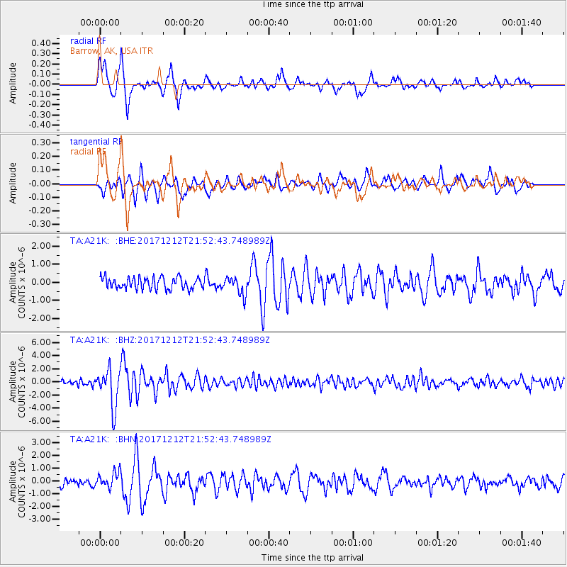
A21K Barrow, AK, USA - Earthquake Result Viewer
*The percent match for this event was below the threshold and hence no stack was calculated.
| Earthquake location: |
Northern And Central Iran |
| Earthquake latitude/longitude: |
30.8/57.3 |
| Earthquake time(UTC): |
2017/12/12 (346) 21:41:31 GMT |
| Earthquake Depth: |
8.0 km |
| Earthquake Magnitude: |
6.0 Mww |
| Earthquake Catalog/Contributor: |
NEIC PDE/us |
|
| Network: |
TA USArray Transportable Network (new EarthScope stations) |
| Station: |
A21K Barrow, AK, USA |
| Lat/Lon: |
71.32 N/156.62 W |
| Elevation: |
577 m |
|
| Distance: |
75.4 deg |
| Az: |
10.704 deg |
| Baz: |
330.268 deg |
| Ray Param: |
$rayparam |
*The percent match for this event was below the threshold and hence was not used in the summary stack. |
|
| Radial Match: |
90.1127 % |
| Radial Bump: |
400 |
| Transverse Match: |
79.750175 % |
| Transverse Bump: |
400 |
| SOD ConfigId: |
13570011 |
| Insert Time: |
2019-04-29 10:29:07.168 +0000 |
| GWidth: |
2.5 |
| Max Bumps: |
400 |
| Tol: |
0.001 |
|
Signal To Noise
| Channel | StoN | STA | LTA |
| TA:A21K: :BHZ:20171212T21:52:43.748989Z | 7.1526523 | 2.9515934E-6 | 4.126572E-7 |
| TA:A21K: :BHN:20171212T21:52:43.748989Z | 2.052255 | 6.282024E-7 | 3.0610346E-7 |
| TA:A21K: :BHE:20171212T21:52:43.748989Z | 1.5925233 | 5.004886E-7 | 3.14274E-7 |
| Arrivals |
| Ps | |
| PpPs | |
| PsPs/PpSs | |


