You are here: Home > Network List > TA - USArray Transportable Network (new EarthScope stations) Stations List
> Station C16K Lisburne Hills, AK, USA > Earthquake Result Viewer
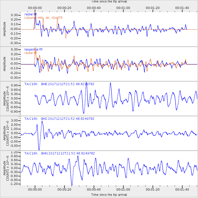
C16K Lisburne Hills, AK, USA - Earthquake Result Viewer
*The percent match for this event was below the threshold and hence no stack was calculated.
| Earthquake location: |
Northern And Central Iran |
| Earthquake latitude/longitude: |
30.8/57.3 |
| Earthquake time(UTC): |
2017/12/12 (346) 21:41:31 GMT |
| Earthquake Depth: |
8.0 km |
| Earthquake Magnitude: |
6.0 Mww |
| Earthquake Catalog/Contributor: |
NEIC PDE/us |
|
| Network: |
TA USArray Transportable Network (new EarthScope stations) |
| Station: |
C16K Lisburne Hills, AK, USA |
| Lat/Lon: |
68.27 N/165.34 W |
| Elevation: |
102 m |
|
| Distance: |
76.3 deg |
| Az: |
15.045 deg |
| Baz: |
323.145 deg |
| Ray Param: |
$rayparam |
*The percent match for this event was below the threshold and hence was not used in the summary stack. |
|
| Radial Match: |
68.68692 % |
| Radial Bump: |
400 |
| Transverse Match: |
66.16281 % |
| Transverse Bump: |
400 |
| SOD ConfigId: |
13570011 |
| Insert Time: |
2019-04-29 10:29:12.995 +0000 |
| GWidth: |
2.5 |
| Max Bumps: |
400 |
| Tol: |
0.001 |
|
Signal To Noise
| Channel | StoN | STA | LTA |
| TA:C16K: :BHZ:20171212T21:52:48.824978Z | 8.699636 | 1.8757579E-6 | 2.1561337E-7 |
| TA:C16K: :BHN:20171212T21:52:48.824978Z | 1.2475399 | 2.7898665E-7 | 2.2362944E-7 |
| TA:C16K: :BHE:20171212T21:52:48.824978Z | 2.3352077 | 5.725175E-7 | 2.4516768E-7 |
| Arrivals |
| Ps | |
| PpPs | |
| PsPs/PpSs | |


