You are here: Home > Network List > TA - USArray Transportable Network (new EarthScope stations) Stations List
> Station J25K Salcha River, AK, USA > Earthquake Result Viewer
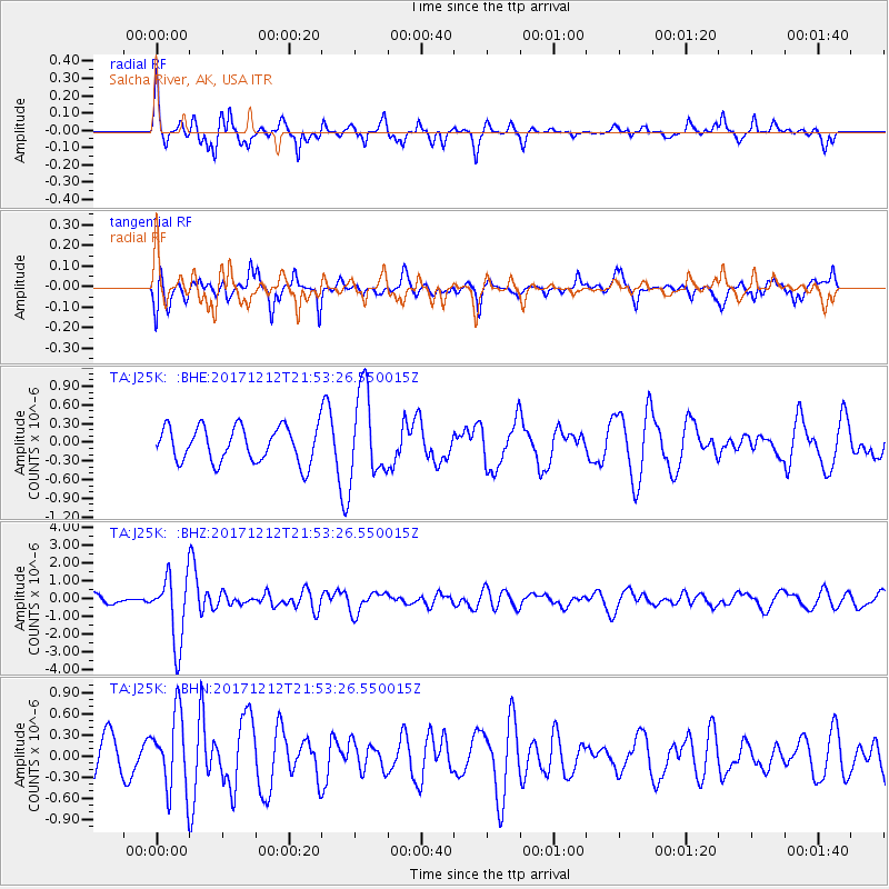
J25K Salcha River, AK, USA - Earthquake Result Viewer
*The percent match for this event was below the threshold and hence no stack was calculated.
| Earthquake location: |
Northern And Central Iran |
| Earthquake latitude/longitude: |
30.8/57.3 |
| Earthquake time(UTC): |
2017/12/12 (346) 21:41:31 GMT |
| Earthquake Depth: |
8.0 km |
| Earthquake Magnitude: |
6.0 Mww |
| Earthquake Catalog/Contributor: |
NEIC PDE/us |
|
| Network: |
TA USArray Transportable Network (new EarthScope stations) |
| Station: |
J25K Salcha River, AK, USA |
| Lat/Lon: |
64.61 N/145.37 W |
| Elevation: |
949 m |
|
| Distance: |
83.2 deg |
| Az: |
9.626 deg |
| Baz: |
340.507 deg |
| Ray Param: |
$rayparam |
*The percent match for this event was below the threshold and hence was not used in the summary stack. |
|
| Radial Match: |
77.666435 % |
| Radial Bump: |
347 |
| Transverse Match: |
65.72268 % |
| Transverse Bump: |
394 |
| SOD ConfigId: |
13570011 |
| Insert Time: |
2019-04-29 10:30:14.150 +0000 |
| GWidth: |
2.5 |
| Max Bumps: |
400 |
| Tol: |
0.001 |
|
Signal To Noise
| Channel | StoN | STA | LTA |
| TA:J25K: :BHZ:20171212T21:53:26.550015Z | 5.153548 | 1.8859791E-6 | 3.6595742E-7 |
| TA:J25K: :BHN:20171212T21:53:26.550015Z | 2.5243819 | 5.382888E-7 | 2.132359E-7 |
| TA:J25K: :BHE:20171212T21:53:26.550015Z | 2.4744139 | 6.977846E-7 | 2.8199997E-7 |
| Arrivals |
| Ps | |
| PpPs | |
| PsPs/PpSs | |


