You are here: Home > Network List > TA - USArray Transportable Network (new EarthScope stations) Stations List
> Station Q22A Crested Butte, Gunnison, CO, USA > Earthquake Result Viewer
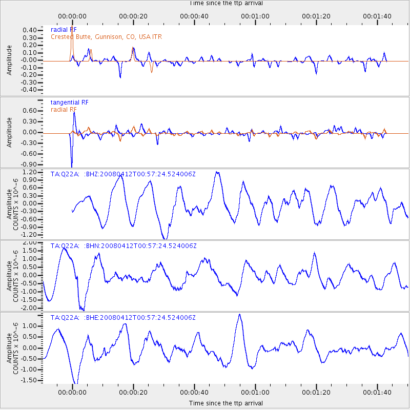
Q22A Crested Butte, Gunnison, CO, USA - Earthquake Result Viewer
*The percent match for this event was below the threshold and hence no stack was calculated.
| Earthquake location: |
Kuril Islands |
| Earthquake latitude/longitude: |
43.9/147.5 |
| Earthquake time(UTC): |
2008/04/12 (103) 00:46:28 GMT |
| Earthquake Depth: |
64 km |
| Earthquake Magnitude: |
5.7 MB |
| Earthquake Catalog/Contributor: |
WHDF/NEIC |
|
| Network: |
TA USArray Transportable Network (new EarthScope stations) |
| Station: |
Q22A Crested Butte, Gunnison, CO, USA |
| Lat/Lon: |
38.86 N/106.91 W |
| Elevation: |
2727 m |
|
| Distance: |
73.7 deg |
| Az: |
51.563 deg |
| Baz: |
313.487 deg |
| Ray Param: |
$rayparam |
*The percent match for this event was below the threshold and hence was not used in the summary stack. |
|
| Radial Match: |
63.188713 % |
| Radial Bump: |
309 |
| Transverse Match: |
41.889923 % |
| Transverse Bump: |
383 |
| SOD ConfigId: |
2504 |
| Insert Time: |
2010-03-06 07:27:32.644 +0000 |
| GWidth: |
2.5 |
| Max Bumps: |
400 |
| Tol: |
0.001 |
|
Signal To Noise
| Channel | StoN | STA | LTA |
| TA:Q22A: :BHN:20080412T00:57:24.524006Z | 2.2808304 | 1.2750386E-6 | 5.590238E-7 |
| TA:Q22A: :BHE:20080412T00:57:24.524006Z | 2.355298 | 1.058425E-6 | 4.4938054E-7 |
| TA:Q22A: :BHZ:20080412T00:57:24.524006Z | 1.7334425 | 9.404647E-7 | 5.425416E-7 |
| Arrivals |
| Ps | |
| PpPs | |
| PsPs/PpSs | |


