You are here: Home > Network List > TA - USArray Transportable Network (new EarthScope stations) Stations List
> Station L15K Ungalak Mountain, AK, USA > Earthquake Result Viewer
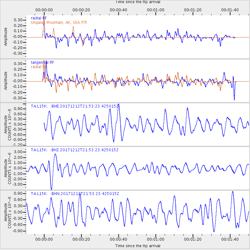
L15K Ungalak Mountain, AK, USA - Earthquake Result Viewer
*The percent match for this event was below the threshold and hence no stack was calculated.
| Earthquake location: |
Northern And Central Iran |
| Earthquake latitude/longitude: |
30.8/57.3 |
| Earthquake time(UTC): |
2017/12/12 (346) 21:41:31 GMT |
| Earthquake Depth: |
8.0 km |
| Earthquake Magnitude: |
6.0 Mww |
| Earthquake Catalog/Contributor: |
NEIC PDE/us |
|
| Network: |
TA USArray Transportable Network (new EarthScope stations) |
| Station: |
L15K Ungalak Mountain, AK, USA |
| Lat/Lon: |
61.68 N/161.49 W |
| Elevation: |
219 m |
|
| Distance: |
82.6 deg |
| Az: |
17.526 deg |
| Baz: |
327.097 deg |
| Ray Param: |
$rayparam |
*The percent match for this event was below the threshold and hence was not used in the summary stack. |
|
| Radial Match: |
64.17158 % |
| Radial Bump: |
400 |
| Transverse Match: |
57.571045 % |
| Transverse Bump: |
376 |
| SOD ConfigId: |
13570011 |
| Insert Time: |
2019-04-29 10:30:21.300 +0000 |
| GWidth: |
2.5 |
| Max Bumps: |
400 |
| Tol: |
0.001 |
|
Signal To Noise
| Channel | StoN | STA | LTA |
| TA:L15K: :BHZ:20171212T21:53:23.425015Z | 3.872172 | 1.6143041E-6 | 4.168988E-7 |
| TA:L15K: :BHN:20171212T21:53:23.425015Z | 0.578069 | 3.3180345E-7 | 5.739859E-7 |
| TA:L15K: :BHE:20171212T21:53:23.425015Z | 0.78186697 | 2.8574595E-7 | 3.654662E-7 |
| Arrivals |
| Ps | |
| PpPs | |
| PsPs/PpSs | |


