You are here: Home > Network List > TA - USArray Transportable Network (new EarthScope stations) Stations List
> Station R33M Jennings River, BC, CAN > Earthquake Result Viewer
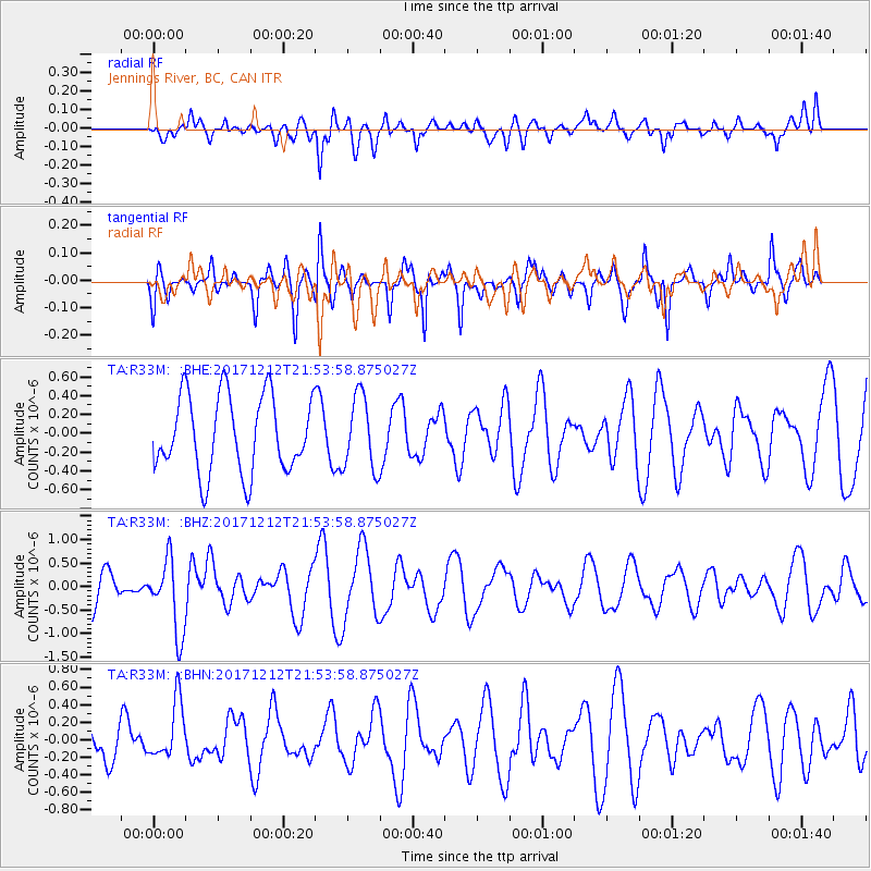
R33M Jennings River, BC, CAN - Earthquake Result Viewer
*The percent match for this event was below the threshold and hence no stack was calculated.
| Earthquake location: |
Northern And Central Iran |
| Earthquake latitude/longitude: |
30.8/57.3 |
| Earthquake time(UTC): |
2017/12/12 (346) 21:41:31 GMT |
| Earthquake Depth: |
8.0 km |
| Earthquake Magnitude: |
6.0 Mww |
| Earthquake Catalog/Contributor: |
NEIC PDE/us |
|
| Network: |
TA USArray Transportable Network (new EarthScope stations) |
| Station: |
R33M Jennings River, BC, CAN |
| Lat/Lon: |
59.39 N/130.97 W |
| Elevation: |
1437 m |
|
| Distance: |
89.9 deg |
| Az: |
4.212 deg |
| Baz: |
352.906 deg |
| Ray Param: |
$rayparam |
*The percent match for this event was below the threshold and hence was not used in the summary stack. |
|
| Radial Match: |
61.188293 % |
| Radial Bump: |
400 |
| Transverse Match: |
57.574406 % |
| Transverse Bump: |
323 |
| SOD ConfigId: |
13570011 |
| Insert Time: |
2019-04-29 10:31:01.999 +0000 |
| GWidth: |
2.5 |
| Max Bumps: |
400 |
| Tol: |
0.001 |
|
Signal To Noise
| Channel | StoN | STA | LTA |
| TA:R33M: :BHZ:20171212T21:53:58.875027Z | 2.0527093 | 7.773142E-7 | 3.7867719E-7 |
| TA:R33M: :BHN:20171212T21:53:58.875027Z | 1.302438 | 3.2806298E-7 | 2.5188373E-7 |
| TA:R33M: :BHE:20171212T21:53:58.875027Z | 0.9516484 | 3.890605E-7 | 4.0882796E-7 |
| Arrivals |
| Ps | |
| PpPs | |
| PsPs/PpSs | |


