You are here: Home > Network List > AZ - ANZA Regional Network Stations List
> Station LVA2 AZ.LVA2 > Earthquake Result Viewer
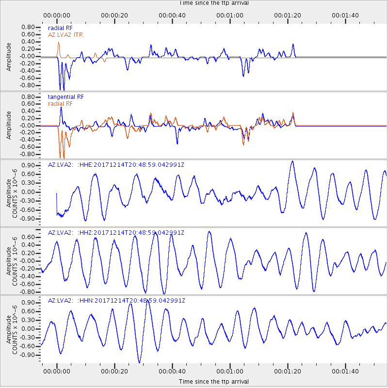
LVA2 AZ.LVA2 - Earthquake Result Viewer
*The percent match for this event was below the threshold and hence no stack was calculated.
| Earthquake location: |
Southeast Of Loyalty Islands |
| Earthquake latitude/longitude: |
-21.1/169.6 |
| Earthquake time(UTC): |
2017/12/14 (348) 20:36:36 GMT |
| Earthquake Depth: |
15 km |
| Earthquake Magnitude: |
5.5 Mww |
| Earthquake Catalog/Contributor: |
NEIC PDE/us |
|
| Network: |
AZ ANZA Regional Network |
| Station: |
LVA2 AZ.LVA2 |
| Lat/Lon: |
33.35 N/116.56 W |
| Elevation: |
1435 m |
|
| Distance: |
88.8 deg |
| Az: |
53.542 deg |
| Baz: |
243.786 deg |
| Ray Param: |
$rayparam |
*The percent match for this event was below the threshold and hence was not used in the summary stack. |
|
| Radial Match: |
66.459755 % |
| Radial Bump: |
400 |
| Transverse Match: |
48.76517 % |
| Transverse Bump: |
400 |
| SOD ConfigId: |
13570011 |
| Insert Time: |
2019-04-29 10:35:23.633 +0000 |
| GWidth: |
2.5 |
| Max Bumps: |
400 |
| Tol: |
0.001 |
|
Signal To Noise
| Channel | StoN | STA | LTA |
| AZ:LVA2: :HHZ:20171214T20:48:59.042991Z | 1.4489114 | 3.61652E-7 | 2.4960258E-7 |
| AZ:LVA2: :HHN:20171214T20:48:59.042991Z | 2.1289485 | 4.876424E-7 | 2.2905317E-7 |
| AZ:LVA2: :HHE:20171214T20:48:59.042991Z | 0.8698304 | 3.7828295E-7 | 4.3489277E-7 |
| Arrivals |
| Ps | |
| PpPs | |
| PsPs/PpSs | |


