You are here: Home > Network List > CI - Caltech Regional Seismic Network Stations List
> Station BFS Mt Baldy Forest Station > Earthquake Result Viewer
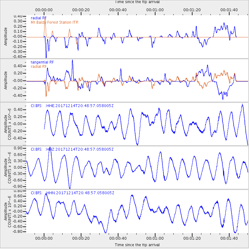
BFS Mt Baldy Forest Station - Earthquake Result Viewer
*The percent match for this event was below the threshold and hence no stack was calculated.
| Earthquake location: |
Southeast Of Loyalty Islands |
| Earthquake latitude/longitude: |
-21.1/169.6 |
| Earthquake time(UTC): |
2017/12/14 (348) 20:36:36 GMT |
| Earthquake Depth: |
15 km |
| Earthquake Magnitude: |
5.5 Mww |
| Earthquake Catalog/Contributor: |
NEIC PDE/us |
|
| Network: |
CI Caltech Regional Seismic Network |
| Station: |
BFS Mt Baldy Forest Station |
| Lat/Lon: |
34.24 N/117.66 W |
| Elevation: |
1312 m |
|
| Distance: |
88.4 deg |
| Az: |
52.342 deg |
| Baz: |
243.149 deg |
| Ray Param: |
$rayparam |
*The percent match for this event was below the threshold and hence was not used in the summary stack. |
|
| Radial Match: |
67.154144 % |
| Radial Bump: |
400 |
| Transverse Match: |
40.34537 % |
| Transverse Bump: |
400 |
| SOD ConfigId: |
13570011 |
| Insert Time: |
2019-04-29 10:35:48.815 +0000 |
| GWidth: |
2.5 |
| Max Bumps: |
400 |
| Tol: |
0.001 |
|
Signal To Noise
| Channel | StoN | STA | LTA |
| CI:BFS: :HHZ:20171214T20:48:57.058005Z | 2.9840422 | 5.56278E-7 | 1.8641761E-7 |
| CI:BFS: :HHN:20171214T20:48:57.058005Z | 2.1214676 | 5.528853E-7 | 2.6061454E-7 |
| CI:BFS: :HHE:20171214T20:48:57.058005Z | 0.7085753 | 1.6119459E-7 | 2.2749111E-7 |
| Arrivals |
| Ps | |
| PpPs | |
| PsPs/PpSs | |


