You are here: Home > Network List > CI - Caltech Regional Seismic Network Stations List
> Station MPP McPhearson Peak > Earthquake Result Viewer
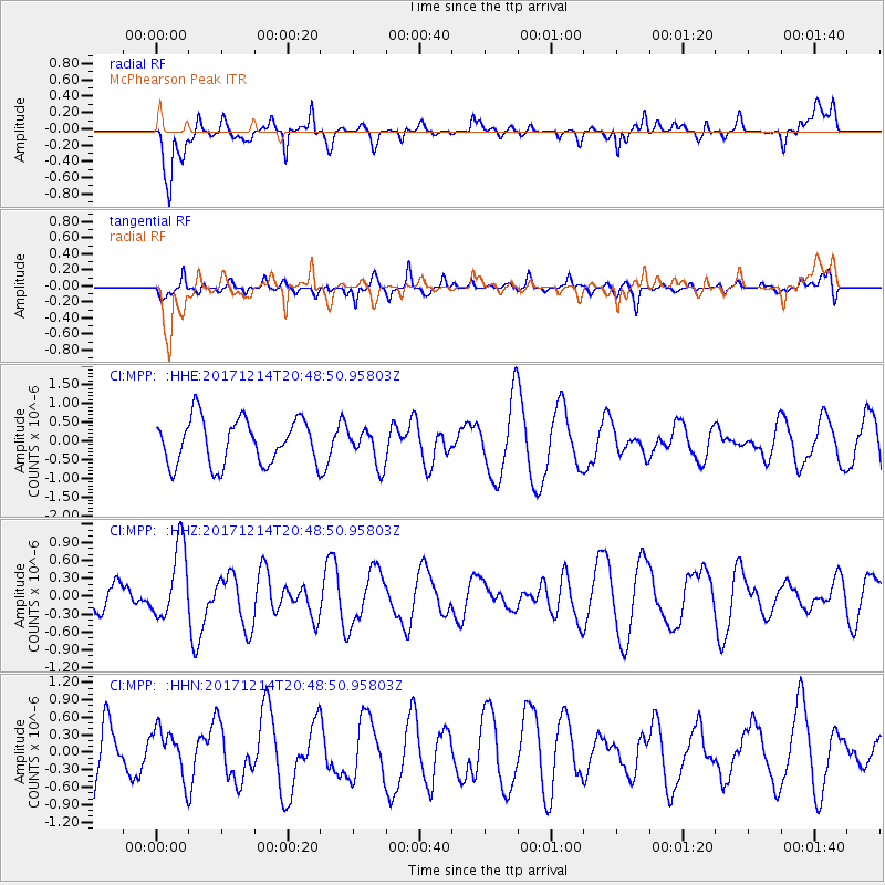
MPP McPhearson Peak - Earthquake Result Viewer
*The percent match for this event was below the threshold and hence no stack was calculated.
| Earthquake location: |
Southeast Of Loyalty Islands |
| Earthquake latitude/longitude: |
-21.1/169.6 |
| Earthquake time(UTC): |
2017/12/14 (348) 20:36:36 GMT |
| Earthquake Depth: |
15 km |
| Earthquake Magnitude: |
5.5 Mww |
| Earthquake Catalog/Contributor: |
NEIC PDE/us |
|
| Network: |
CI Caltech Regional Seismic Network |
| Station: |
MPP McPhearson Peak |
| Lat/Lon: |
34.89 N/119.81 W |
| Elevation: |
1739 m |
|
| Distance: |
87.1 deg |
| Az: |
50.945 deg |
| Baz: |
241.877 deg |
| Ray Param: |
$rayparam |
*The percent match for this event was below the threshold and hence was not used in the summary stack. |
|
| Radial Match: |
65.41978 % |
| Radial Bump: |
400 |
| Transverse Match: |
53.930206 % |
| Transverse Bump: |
400 |
| SOD ConfigId: |
13570011 |
| Insert Time: |
2019-04-29 10:36:04.599 +0000 |
| GWidth: |
2.5 |
| Max Bumps: |
400 |
| Tol: |
0.001 |
|
Signal To Noise
| Channel | StoN | STA | LTA |
| CI:MPP: :HHZ:20171214T20:48:50.95803Z | 2.0614119 | 6.03897E-7 | 2.929531E-7 |
| CI:MPP: :HHN:20171214T20:48:50.95803Z | 0.9590615 | 4.1245193E-7 | 4.3005784E-7 |
| CI:MPP: :HHE:20171214T20:48:50.95803Z | 0.7464505 | 4.4602933E-7 | 5.975337E-7 |
| Arrivals |
| Ps | |
| PpPs | |
| PsPs/PpSs | |


