You are here: Home > Network List > PS - Pacific21 Stations List
> Station PSI Parapat, Indonesia > Earthquake Result Viewer
PSI Parapat, Indonesia - Earthquake Result Viewer
*The percent match for this event was below the threshold and hence no stack was calculated.
| Earthquake location: |
Southeast Of Loyalty Islands |
| Earthquake latitude/longitude: |
-21.1/169.6 |
| Earthquake time(UTC): |
2017/12/14 (348) 20:36:36 GMT |
| Earthquake Depth: |
15 km |
| Earthquake Magnitude: |
5.5 Mww |
| Earthquake Catalog/Contributor: |
NEIC PDE/us |
|
| Network: |
PS Pacific21 |
| Station: |
PSI Parapat, Indonesia |
| Lat/Lon: |
2.69 N/98.92 E |
| Elevation: |
987 m |
|
| Distance: |
73.0 deg |
| Az: |
279.77 deg |
| Baz: |
112.913 deg |
| Ray Param: |
$rayparam |
*The percent match for this event was below the threshold and hence was not used in the summary stack. |
|
| Radial Match: |
63.940075 % |
| Radial Bump: |
400 |
| Transverse Match: |
60.486168 % |
| Transverse Bump: |
400 |
| SOD ConfigId: |
13570011 |
| Insert Time: |
2019-04-29 10:37:27.592 +0000 |
| GWidth: |
2.5 |
| Max Bumps: |
400 |
| Tol: |
0.001 |
|
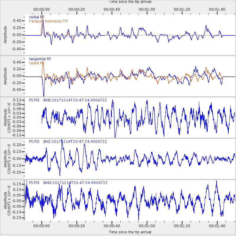
Signal To Noise
| Channel | StoN | STA | LTA |
| PS:PSI: :BHZ:20171214T20:47:34.660972Z | 2.6665106 | 8.9736744E-8 | 3.3653247E-8 |
| PS:PSI: :BHN:20171214T20:47:34.660972Z | 0.8012135 | 4.3827004E-8 | 5.4700784E-8 |
| PS:PSI: :BHE:20171214T20:47:34.660972Z | 1.6040443 | 5.6080392E-8 | 3.496187E-8 |
| Arrivals |
| Ps | |
| PpPs | |
| PsPs/PpSs | |


