You are here: Home > Network List > CI - Caltech Regional Seismic Network Stations List
> Station BFS Mt Baldy Forest Station > Earthquake Result Viewer
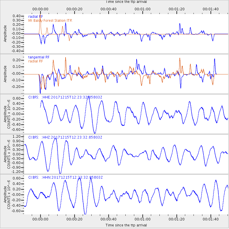
BFS Mt Baldy Forest Station - Earthquake Result Viewer
*The percent match for this event was below the threshold and hence no stack was calculated.
| Earthquake location: |
Tonga Islands |
| Earthquake latitude/longitude: |
-21.9/-174.4 |
| Earthquake time(UTC): |
2017/12/15 (349) 12:12:07 GMT |
| Earthquake Depth: |
10 km |
| Earthquake Magnitude: |
5.3 Mww |
| Earthquake Catalog/Contributor: |
NEIC PDE/us |
|
| Network: |
CI Caltech Regional Seismic Network |
| Station: |
BFS Mt Baldy Forest Station |
| Lat/Lon: |
34.24 N/117.66 W |
| Elevation: |
1312 m |
|
| Distance: |
77.6 deg |
| Az: |
45.18 deg |
| Baz: |
232.687 deg |
| Ray Param: |
$rayparam |
*The percent match for this event was below the threshold and hence was not used in the summary stack. |
|
| Radial Match: |
71.68829 % |
| Radial Bump: |
400 |
| Transverse Match: |
39.693134 % |
| Transverse Bump: |
400 |
| SOD ConfigId: |
13570011 |
| Insert Time: |
2019-04-29 10:41:08.978 +0000 |
| GWidth: |
2.5 |
| Max Bumps: |
400 |
| Tol: |
0.001 |
|
Signal To Noise
| Channel | StoN | STA | LTA |
| CI:BFS: :HHZ:20171215T12:23:32.85803Z | 2.1434307 | 7.341511E-7 | 3.4251218E-7 |
| CI:BFS: :HHN:20171215T12:23:32.85803Z | 0.2696852 | 8.385647E-8 | 3.1094206E-7 |
| CI:BFS: :HHE:20171215T12:23:32.85803Z | 1.6562635 | 4.4656232E-7 | 2.6962036E-7 |
| Arrivals |
| Ps | |
| PpPs | |
| PsPs/PpSs | |


