You are here: Home > Network List > TA - USArray Transportable Network (new EarthScope stations) Stations List
> Station M16K Timber Creek, AK, USA > Earthquake Result Viewer
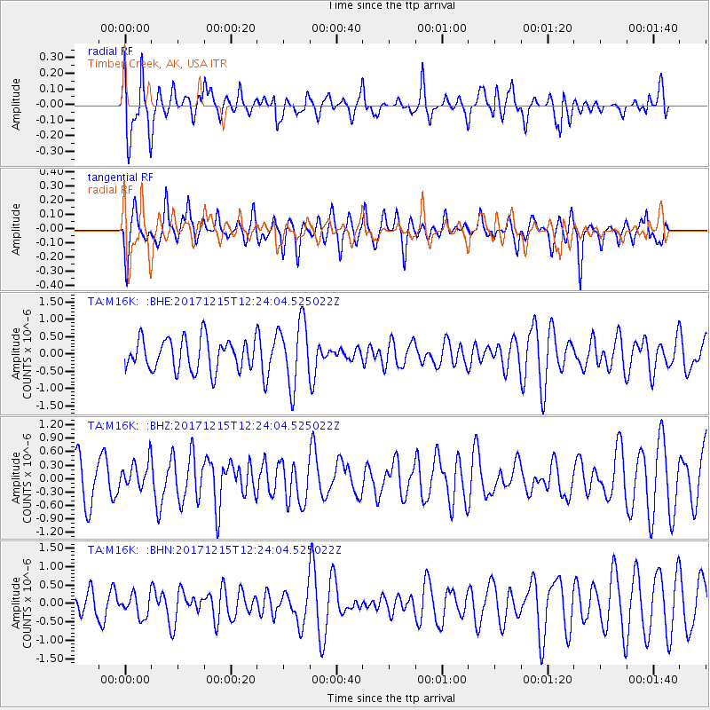
M16K Timber Creek, AK, USA - Earthquake Result Viewer
*The percent match for this event was below the threshold and hence no stack was calculated.
| Earthquake location: |
Tonga Islands |
| Earthquake latitude/longitude: |
-21.9/-174.4 |
| Earthquake time(UTC): |
2017/12/15 (349) 12:12:07 GMT |
| Earthquake Depth: |
10 km |
| Earthquake Magnitude: |
5.3 Mww |
| Earthquake Catalog/Contributor: |
NEIC PDE/us |
|
| Network: |
TA USArray Transportable Network (new EarthScope stations) |
| Station: |
M16K Timber Creek, AK, USA |
| Lat/Lon: |
61.02 N/158.96 W |
| Elevation: |
394 m |
|
| Distance: |
83.5 deg |
| Az: |
7.5 deg |
| Baz: |
194.417 deg |
| Ray Param: |
$rayparam |
*The percent match for this event was below the threshold and hence was not used in the summary stack. |
|
| Radial Match: |
63.992634 % |
| Radial Bump: |
400 |
| Transverse Match: |
51.561523 % |
| Transverse Bump: |
400 |
| SOD ConfigId: |
13570011 |
| Insert Time: |
2019-04-29 10:44:22.390 +0000 |
| GWidth: |
2.5 |
| Max Bumps: |
400 |
| Tol: |
0.001 |
|
Signal To Noise
| Channel | StoN | STA | LTA |
| TA:M16K: :BHZ:20171215T12:24:04.525022Z | 0.94480634 | 3.1360187E-7 | 3.3192183E-7 |
| TA:M16K: :BHN:20171215T12:24:04.525022Z | 1.0866567 | 3.019715E-7 | 2.7789042E-7 |
| TA:M16K: :BHE:20171215T12:24:04.525022Z | 2.0475593 | 9.2092404E-7 | 4.4976676E-7 |
| Arrivals |
| Ps | |
| PpPs | |
| PsPs/PpSs | |


