You are here: Home > Network List > AV - Alaska Volcano Observatory Stations List
> Station AMKA Regional Station, Amchitka Island, Alaska > Earthquake Result Viewer
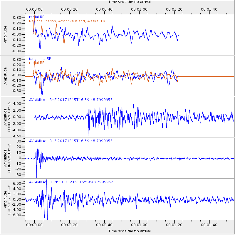
AMKA Regional Station, Amchitka Island, Alaska - Earthquake Result Viewer
*The percent match for this event was below the threshold and hence no stack was calculated.
| Earthquake location: |
Java, Indonesia |
| Earthquake latitude/longitude: |
-7.7/108.0 |
| Earthquake time(UTC): |
2017/12/15 (349) 16:47:56 GMT |
| Earthquake Depth: |
92 km |
| Earthquake Magnitude: |
6.5 Mww |
| Earthquake Catalog/Contributor: |
NEIC PDE/us |
|
| Network: |
AV Alaska Volcano Observatory |
| Station: |
AMKA Regional Station, Amchitka Island, Alaska |
| Lat/Lon: |
51.38 N/179.30 E |
| Elevation: |
116 m |
|
| Distance: |
84.5 deg |
| Az: |
36.604 deg |
| Baz: |
250.539 deg |
| Ray Param: |
$rayparam |
*The percent match for this event was below the threshold and hence was not used in the summary stack. |
|
| Radial Match: |
74.38295 % |
| Radial Bump: |
400 |
| Transverse Match: |
81.15435 % |
| Transverse Bump: |
400 |
| SOD ConfigId: |
13570011 |
| Insert Time: |
2019-04-29 10:46:52.539 +0000 |
| GWidth: |
2.5 |
| Max Bumps: |
400 |
| Tol: |
0.001 |
|
Signal To Noise
| Channel | StoN | STA | LTA |
| AV:AMKA: :BHZ:20171215T16:59:48.799995Z | 18.232716 | 1.0349957E-5 | 5.6765856E-7 |
| AV:AMKA: :BHN:20171215T16:59:48.799995Z | 4.205052 | 1.617752E-6 | 3.8471626E-7 |
| AV:AMKA: :BHE:20171215T16:59:48.799995Z | 4.948479 | 1.8860578E-6 | 3.8113888E-7 |
| Arrivals |
| Ps | |
| PpPs | |
| PsPs/PpSs | |


