You are here: Home > Network List > TA - USArray Transportable Network (new EarthScope stations) Stations List
> Station Z24A Sheeppen Canyon, Tinnie, NM, USA > Earthquake Result Viewer
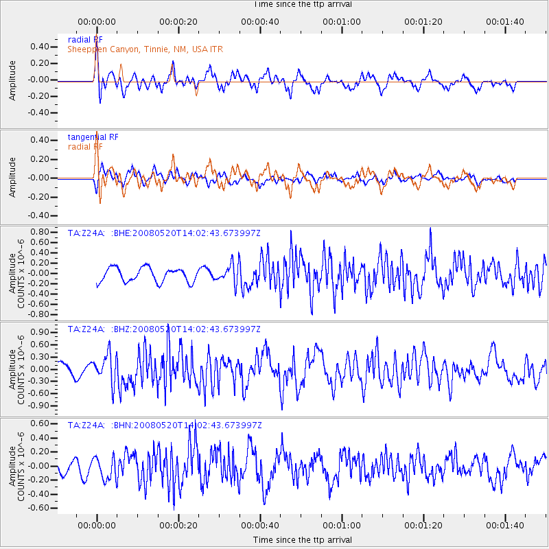
Z24A Sheeppen Canyon, Tinnie, NM, USA - Earthquake Result Viewer
*The percent match for this event was below the threshold and hence no stack was calculated.
| Earthquake location: |
Rat Islands, Aleutian Islands |
| Earthquake latitude/longitude: |
51.2/178.8 |
| Earthquake time(UTC): |
2008/05/20 (141) 13:53:35 GMT |
| Earthquake Depth: |
27 km |
| Earthquake Magnitude: |
5.8 MB, 6.0 MS, 6.3 MW, 6.3 MW |
| Earthquake Catalog/Contributor: |
WHDF/NEIC |
|
| Network: |
TA USArray Transportable Network (new EarthScope stations) |
| Station: |
Z24A Sheeppen Canyon, Tinnie, NM, USA |
| Lat/Lon: |
33.33 N/105.36 W |
| Elevation: |
1863 m |
|
| Distance: |
56.4 deg |
| Az: |
77.12 deg |
| Baz: |
312.846 deg |
| Ray Param: |
$rayparam |
*The percent match for this event was below the threshold and hence was not used in the summary stack. |
|
| Radial Match: |
77.92556 % |
| Radial Bump: |
400 |
| Transverse Match: |
64.796776 % |
| Transverse Bump: |
400 |
| SOD ConfigId: |
2504 |
| Insert Time: |
2010-03-06 07:30:17.302 +0000 |
| GWidth: |
2.5 |
| Max Bumps: |
400 |
| Tol: |
0.001 |
|
Signal To Noise
| Channel | StoN | STA | LTA |
| TA:Z24A: :BHZ:20080520T14:02:43.673997Z | 1.9710004 | 3.6038716E-7 | 1.8284479E-7 |
| TA:Z24A: :BHN:20080520T14:02:43.673997Z | 1.9745169 | 1.6454817E-7 | 8.333591E-8 |
| TA:Z24A: :BHE:20080520T14:02:43.673997Z | 1.3942667 | 1.8790345E-7 | 1.3476865E-7 |
| Arrivals |
| Ps | |
| PpPs | |
| PsPs/PpSs | |


