You are here: Home > Network List > TA - USArray Transportable Network (new EarthScope stations) Stations List
> Station B18K Kokolik River, AK, USA > Earthquake Result Viewer
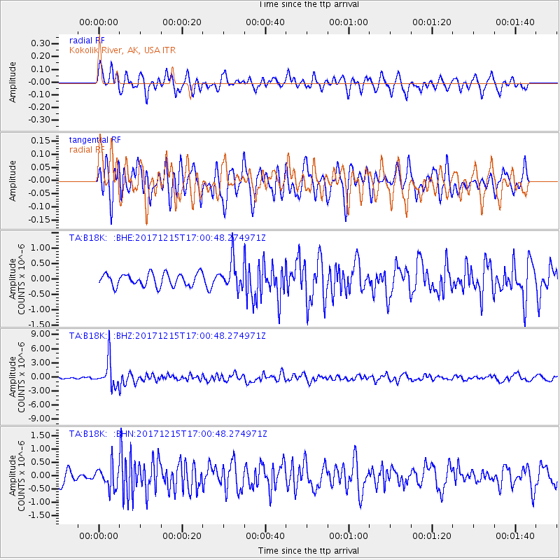
B18K Kokolik River, AK, USA - Earthquake Result Viewer
*The percent match for this event was below the threshold and hence no stack was calculated.
| Earthquake location: |
Java, Indonesia |
| Earthquake latitude/longitude: |
-7.7/108.0 |
| Earthquake time(UTC): |
2017/12/15 (349) 16:47:56 GMT |
| Earthquake Depth: |
92 km |
| Earthquake Magnitude: |
6.5 Mww |
| Earthquake Catalog/Contributor: |
NEIC PDE/us |
|
| Network: |
TA USArray Transportable Network (new EarthScope stations) |
| Station: |
B18K Kokolik River, AK, USA |
| Lat/Lon: |
69.36 N/161.80 W |
| Elevation: |
222 m |
|
| Distance: |
97.2 deg |
| Az: |
20.938 deg |
| Baz: |
267.426 deg |
| Ray Param: |
$rayparam |
*The percent match for this event was below the threshold and hence was not used in the summary stack. |
|
| Radial Match: |
75.76148 % |
| Radial Bump: |
400 |
| Transverse Match: |
73.226036 % |
| Transverse Bump: |
400 |
| SOD ConfigId: |
13570011 |
| Insert Time: |
2019-04-29 10:48:51.828 +0000 |
| GWidth: |
2.5 |
| Max Bumps: |
400 |
| Tol: |
0.001 |
|
Signal To Noise
| Channel | StoN | STA | LTA |
| TA:B18K: :BHZ:20171215T17:00:48.274971Z | 15.855256 | 2.9948221E-6 | 1.8888514E-7 |
| TA:B18K: :BHN:20171215T17:00:48.274971Z | 1.5424908 | 4.1621993E-7 | 2.6983625E-7 |
| TA:B18K: :BHE:20171215T17:00:48.274971Z | 2.3016198 | 4.6284634E-7 | 2.0109592E-7 |
| Arrivals |
| Ps | |
| PpPs | |
| PsPs/PpSs | |


