You are here: Home > Network List > TA - USArray Transportable Network (new EarthScope stations) Stations List
> Station L15K Ungalak Mountain, AK, USA > Earthquake Result Viewer
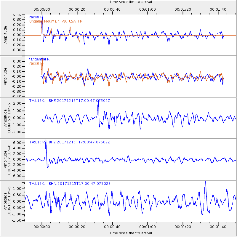
L15K Ungalak Mountain, AK, USA - Earthquake Result Viewer
*The percent match for this event was below the threshold and hence no stack was calculated.
| Earthquake location: |
Java, Indonesia |
| Earthquake latitude/longitude: |
-7.7/108.0 |
| Earthquake time(UTC): |
2017/12/15 (349) 16:47:56 GMT |
| Earthquake Depth: |
92 km |
| Earthquake Magnitude: |
6.5 Mww |
| Earthquake Catalog/Contributor: |
NEIC PDE/us |
|
| Network: |
TA USArray Transportable Network (new EarthScope stations) |
| Station: |
L15K Ungalak Mountain, AK, USA |
| Lat/Lon: |
61.68 N/161.49 W |
| Elevation: |
219 m |
|
| Distance: |
97.0 deg |
| Az: |
28.714 deg |
| Baz: |
266.748 deg |
| Ray Param: |
$rayparam |
*The percent match for this event was below the threshold and hence was not used in the summary stack. |
|
| Radial Match: |
57.042374 % |
| Radial Bump: |
400 |
| Transverse Match: |
52.69212 % |
| Transverse Bump: |
362 |
| SOD ConfigId: |
13570011 |
| Insert Time: |
2019-04-29 10:49:08.331 +0000 |
| GWidth: |
2.5 |
| Max Bumps: |
400 |
| Tol: |
0.001 |
|
Signal To Noise
| Channel | StoN | STA | LTA |
| TA:L15K: :BHZ:20171215T17:00:47.07502Z | 5.0602036 | 2.3902494E-6 | 4.7236227E-7 |
| TA:L15K: :BHN:20171215T17:00:47.07502Z | 1.4458358 | 3.879638E-7 | 2.6833186E-7 |
| TA:L15K: :BHE:20171215T17:00:47.07502Z | 2.3197136 | 9.160734E-7 | 3.9490797E-7 |
| Arrivals |
| Ps | |
| PpPs | |
| PsPs/PpSs | |


