You are here: Home > Network List > TA - USArray Transportable Network (new EarthScope stations) Stations List
> Station M11K Mekoryuk, AK, USA > Earthquake Result Viewer
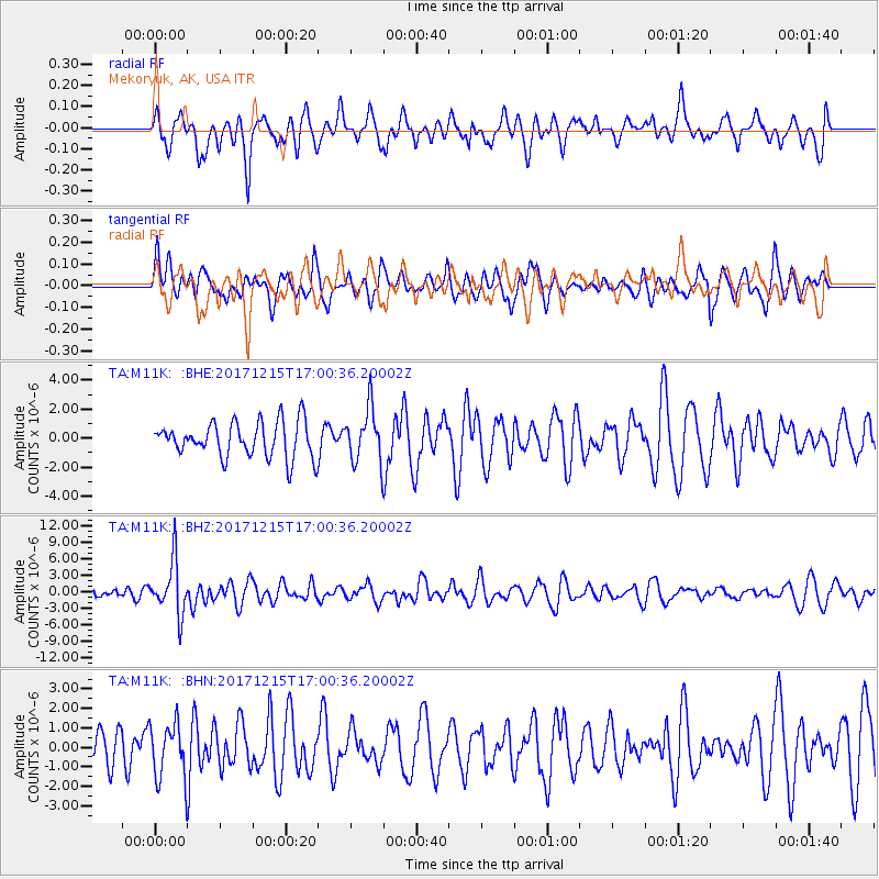
M11K Mekoryuk, AK, USA - Earthquake Result Viewer
*The percent match for this event was below the threshold and hence no stack was calculated.
| Earthquake location: |
Java, Indonesia |
| Earthquake latitude/longitude: |
-7.7/108.0 |
| Earthquake time(UTC): |
2017/12/15 (349) 16:47:56 GMT |
| Earthquake Depth: |
92 km |
| Earthquake Magnitude: |
6.5 Mww |
| Earthquake Catalog/Contributor: |
NEIC PDE/us |
|
| Network: |
TA USArray Transportable Network (new EarthScope stations) |
| Station: |
M11K Mekoryuk, AK, USA |
| Lat/Lon: |
60.38 N/166.20 W |
| Elevation: |
3.0 m |
|
| Distance: |
94.6 deg |
| Az: |
29.796 deg |
| Baz: |
262.52 deg |
| Ray Param: |
$rayparam |
*The percent match for this event was below the threshold and hence was not used in the summary stack. |
|
| Radial Match: |
45.125095 % |
| Radial Bump: |
394 |
| Transverse Match: |
47.39126 % |
| Transverse Bump: |
400 |
| SOD ConfigId: |
13570011 |
| Insert Time: |
2019-04-29 10:49:10.947 +0000 |
| GWidth: |
2.5 |
| Max Bumps: |
400 |
| Tol: |
0.001 |
|
Signal To Noise
| Channel | StoN | STA | LTA |
| TA:M11K: :BHZ:20171215T17:00:36.20002Z | 3.6390045 | 4.7784747E-6 | 1.313127E-6 |
| TA:M11K: :BHN:20171215T17:00:36.20002Z | 1.2661959 | 1.4557774E-6 | 1.1497251E-6 |
| TA:M11K: :BHE:20171215T17:00:36.20002Z | 1.4432349 | 1.7323121E-6 | 1.200298E-6 |
| Arrivals |
| Ps | |
| PpPs | |
| PsPs/PpSs | |


