You are here: Home > Network List > CI - Caltech Regional Seismic Network Stations List
> Station BFS Mt Baldy Forest Station > Earthquake Result Viewer
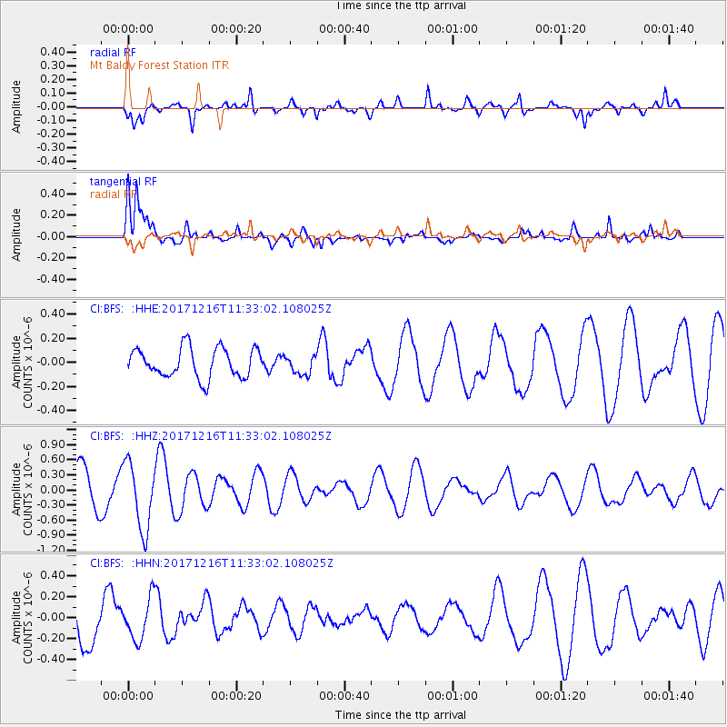
BFS Mt Baldy Forest Station - Earthquake Result Viewer
*The percent match for this event was below the threshold and hence no stack was calculated.
| Earthquake location: |
Fiji Islands Region |
| Earthquake latitude/longitude: |
-17.3/-177.5 |
| Earthquake time(UTC): |
2017/12/16 (350) 11:22:24 GMT |
| Earthquake Depth: |
391 km |
| Earthquake Magnitude: |
5.5 Mww |
| Earthquake Catalog/Contributor: |
NEIC PDE/us |
|
| Network: |
CI Caltech Regional Seismic Network |
| Station: |
BFS Mt Baldy Forest Station |
| Lat/Lon: |
34.24 N/117.66 W |
| Elevation: |
1312 m |
|
| Distance: |
76.6 deg |
| Az: |
47.438 deg |
| Baz: |
238.123 deg |
| Ray Param: |
$rayparam |
*The percent match for this event was below the threshold and hence was not used in the summary stack. |
|
| Radial Match: |
55.089905 % |
| Radial Bump: |
400 |
| Transverse Match: |
69.00052 % |
| Transverse Bump: |
400 |
| SOD ConfigId: |
13570011 |
| Insert Time: |
2019-04-29 10:53:51.829 +0000 |
| GWidth: |
2.5 |
| Max Bumps: |
400 |
| Tol: |
0.001 |
|
Signal To Noise
| Channel | StoN | STA | LTA |
| CI:BFS: :HHZ:20171216T11:33:02.108025Z | 2.0313783 | 6.7019704E-7 | 3.2992233E-7 |
| CI:BFS: :HHN:20171216T11:33:02.108025Z | 0.6016958 | 1.9741549E-7 | 3.2809854E-7 |
| CI:BFS: :HHE:20171216T11:33:02.108025Z | 0.64423823 | 7.85826E-8 | 1.2197755E-7 |
| Arrivals |
| Ps | |
| PpPs | |
| PsPs/PpSs | |


