You are here: Home > Network List > TA - USArray Transportable Network (new EarthScope stations) Stations List
> Station J26L Joseph Creek, AK, USA > Earthquake Result Viewer
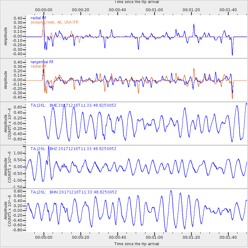
J26L Joseph Creek, AK, USA - Earthquake Result Viewer
*The percent match for this event was below the threshold and hence no stack was calculated.
| Earthquake location: |
Fiji Islands Region |
| Earthquake latitude/longitude: |
-17.3/-177.5 |
| Earthquake time(UTC): |
2017/12/16 (350) 11:22:24 GMT |
| Earthquake Depth: |
391 km |
| Earthquake Magnitude: |
5.5 Mww |
| Earthquake Catalog/Contributor: |
NEIC PDE/us |
|
| Network: |
TA USArray Transportable Network (new EarthScope stations) |
| Station: |
J26L Joseph Creek, AK, USA |
| Lat/Lon: |
64.50 N/143.56 W |
| Elevation: |
1144 m |
|
| Distance: |
85.6 deg |
| Az: |
14.039 deg |
| Baz: |
212.364 deg |
| Ray Param: |
$rayparam |
*The percent match for this event was below the threshold and hence was not used in the summary stack. |
|
| Radial Match: |
64.43933 % |
| Radial Bump: |
400 |
| Transverse Match: |
57.111828 % |
| Transverse Bump: |
400 |
| SOD ConfigId: |
13570011 |
| Insert Time: |
2019-04-29 10:57:00.705 +0000 |
| GWidth: |
2.5 |
| Max Bumps: |
400 |
| Tol: |
0.001 |
|
Signal To Noise
| Channel | StoN | STA | LTA |
| TA:J26L: :BHZ:20171216T11:33:48.825005Z | 2.2373922 | 7.563812E-7 | 3.3806376E-7 |
| TA:J26L: :BHN:20171216T11:33:48.825005Z | 1.1539304 | 2.3400827E-7 | 2.0279234E-7 |
| TA:J26L: :BHE:20171216T11:33:48.825005Z | 0.8510081 | 3.387401E-7 | 3.980457E-7 |
| Arrivals |
| Ps | |
| PpPs | |
| PsPs/PpSs | |


