You are here: Home > Network List > TA - USArray Transportable Network (new EarthScope stations) Stations List
> Station A36M Sachs Harbour, NT, CAN > Earthquake Result Viewer
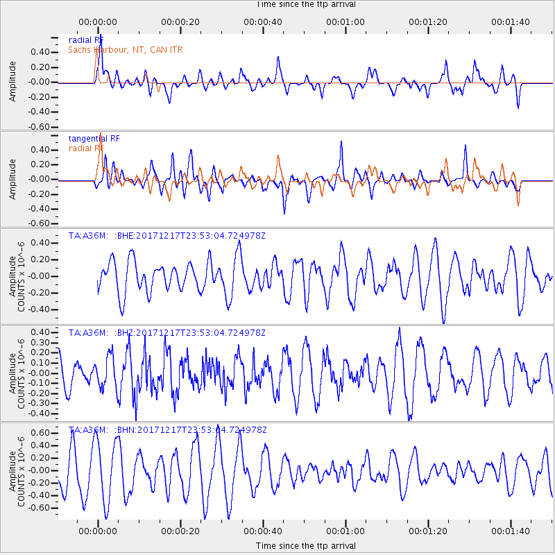
A36M Sachs Harbour, NT, CAN - Earthquake Result Viewer
*The percent match for this event was below the threshold and hence no stack was calculated.
| Earthquake location: |
W. Caroline Islands, Micronesia |
| Earthquake latitude/longitude: |
10.0/140.2 |
| Earthquake time(UTC): |
2017/12/17 (351) 23:41:16 GMT |
| Earthquake Depth: |
10 km |
| Earthquake Magnitude: |
5.5 mb |
| Earthquake Catalog/Contributor: |
NEIC PDE/us |
|
| Network: |
TA USArray Transportable Network (new EarthScope stations) |
| Station: |
A36M Sachs Harbour, NT, CAN |
| Lat/Lon: |
71.99 N/125.25 W |
| Elevation: |
32 m |
|
| Distance: |
82.0 deg |
| Az: |
18.252 deg |
| Baz: |
277.481 deg |
| Ray Param: |
$rayparam |
*The percent match for this event was below the threshold and hence was not used in the summary stack. |
|
| Radial Match: |
68.67933 % |
| Radial Bump: |
400 |
| Transverse Match: |
58.16309 % |
| Transverse Bump: |
400 |
| SOD ConfigId: |
13570011 |
| Insert Time: |
2019-04-29 11:05:24.647 +0000 |
| GWidth: |
2.5 |
| Max Bumps: |
400 |
| Tol: |
0.001 |
|
Signal To Noise
| Channel | StoN | STA | LTA |
| TA:A36M: :BHZ:20171217T23:53:04.724978Z | 0.6502624 | 1.5746483E-7 | 2.4215583E-7 |
| TA:A36M: :BHN:20171217T23:53:04.724978Z | 2.200833 | 5.003072E-7 | 2.2732628E-7 |
| TA:A36M: :BHE:20171217T23:53:04.724978Z | 1.5100514 | 2.650473E-7 | 1.7552206E-7 |
| Arrivals |
| Ps | |
| PpPs | |
| PsPs/PpSs | |


