You are here: Home > Network List > TA - USArray Transportable Network (new EarthScope stations) Stations List
> Station I30M Mount Dempster, Yukon, CAN > Earthquake Result Viewer
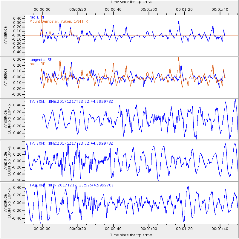
I30M Mount Dempster, Yukon, CAN - Earthquake Result Viewer
*The percent match for this event was below the threshold and hence no stack was calculated.
| Earthquake location: |
W. Caroline Islands, Micronesia |
| Earthquake latitude/longitude: |
10.0/140.2 |
| Earthquake time(UTC): |
2017/12/17 (351) 23:41:16 GMT |
| Earthquake Depth: |
10 km |
| Earthquake Magnitude: |
5.5 mb |
| Earthquake Catalog/Contributor: |
NEIC PDE/us |
|
| Network: |
TA USArray Transportable Network (new EarthScope stations) |
| Station: |
I30M Mount Dempster, Yukon, CAN |
| Lat/Lon: |
65.22 N/136.38 W |
| Elevation: |
1399 m |
|
| Distance: |
78.2 deg |
| Az: |
25.322 deg |
| Baz: |
268.325 deg |
| Ray Param: |
$rayparam |
*The percent match for this event was below the threshold and hence was not used in the summary stack. |
|
| Radial Match: |
55.504124 % |
| Radial Bump: |
400 |
| Transverse Match: |
60.849545 % |
| Transverse Bump: |
400 |
| SOD ConfigId: |
13570011 |
| Insert Time: |
2019-04-29 11:05:39.798 +0000 |
| GWidth: |
2.5 |
| Max Bumps: |
400 |
| Tol: |
0.001 |
|
Signal To Noise
| Channel | StoN | STA | LTA |
| TA:I30M: :BHZ:20171217T23:52:44.599978Z | 0.44424513 | 1.5213845E-7 | 3.424651E-7 |
| TA:I30M: :BHN:20171217T23:52:44.599978Z | 1.6506026 | 3.532701E-7 | 2.1402494E-7 |
| TA:I30M: :BHE:20171217T23:52:44.599978Z | 0.46007565 | 9.495395E-8 | 2.0638767E-7 |
| Arrivals |
| Ps | |
| PpPs | |
| PsPs/PpSs | |


