You are here: Home > Network List > TA - USArray Transportable Network (new EarthScope stations) Stations List
> Station N22A Wattenberg Ranch, Walden, CO, USA > Earthquake Result Viewer
N22A Wattenberg Ranch, Walden, CO, USA - Earthquake Result Viewer

| Earthquake location: |
Kuril Islands |
| Earthquake latitude/longitude: |
46.0/151.4 |
| Earthquake time(UTC): |
2009/04/18 (108) 19:17:58 GMT |
| Earthquake Depth: |
35 km |
| Earthquake Magnitude: |
6.3 MB, 6.3 MS, 6.6 MW, 6.4 MW |
| Earthquake Catalog/Contributor: |
WHDF/NEIC |
|
| Network: |
TA USArray Transportable Network (new EarthScope stations) |
| Station: |
N22A Wattenberg Ranch, Walden, CO, USA |
| Lat/Lon: |
40.80 N/106.45 W |
| Elevation: |
2472 m |
|
| Distance: |
69.2 deg |
| Az: |
52.578 deg |
| Baz: |
313.193 deg |
| Ray Param: |
0.055777006 |
| Estimated Moho Depth: |
44.25 km |
| Estimated Crust Vp/Vs: |
1.61 |
| Assumed Crust Vp: |
6.159 km/s |
| Estimated Crust Vs: |
3.831 km/s |
| Estimated Crust Poisson's Ratio: |
0.18 |
|
| Radial Match: |
90.68038 % |
| Radial Bump: |
400 |
| Transverse Match: |
85.686195 % |
| Transverse Bump: |
400 |
| SOD ConfigId: |
2760 |
| Insert Time: |
2010-03-06 07:32:29.977 +0000 |
| GWidth: |
2.5 |
| Max Bumps: |
400 |
| Tol: |
0.001 |
|
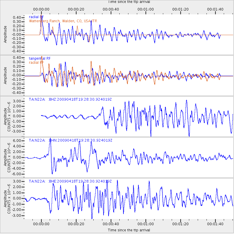
Signal To Noise
| Channel | StoN | STA | LTA |
| TA:N22A: :BHN:20090418T19:28:30.924019Z | 16.73425 | 1.5459386E-6 | 9.238172E-8 |
| TA:N22A: :BHE:20090418T19:28:30.924019Z | 1.8482865 | 3.839259E-7 | 2.077199E-7 |
| TA:N22A: :BHZ:20090418T19:28:30.924019Z | 2.363508 | 4.855387E-7 | 2.0543138E-7 |
| Arrivals |
| Ps | 4.5 SECOND |
| PpPs | 18 SECOND |
| PsPs/PpSs | 23 SECOND |


