You are here: Home > Network List > TA - USArray Transportable Network (new EarthScope stations) Stations List
> Station I23K Minto, Yukon-Koyukuk, AK, USA > Earthquake Result Viewer
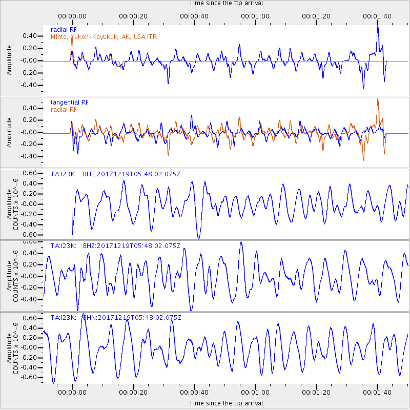
I23K Minto, Yukon-Koyukuk, AK, USA - Earthquake Result Viewer
*The percent match for this event was below the threshold and hence no stack was calculated.
| Earthquake location: |
Southern East Pacific Rise |
| Earthquake latitude/longitude: |
-21.9/-114.2 |
| Earthquake time(UTC): |
2017/12/19 (353) 05:35:29 GMT |
| Earthquake Depth: |
10 km |
| Earthquake Magnitude: |
5.6 mb |
| Earthquake Catalog/Contributor: |
NEIC PDE/us |
|
| Network: |
TA USArray Transportable Network (new EarthScope stations) |
| Station: |
I23K Minto, Yukon-Koyukuk, AK, USA |
| Lat/Lon: |
65.15 N/149.36 W |
| Elevation: |
149 m |
|
| Distance: |
90.9 deg |
| Az: |
345.931 deg |
| Baz: |
147.715 deg |
| Ray Param: |
$rayparam |
*The percent match for this event was below the threshold and hence was not used in the summary stack. |
|
| Radial Match: |
67.06341 % |
| Radial Bump: |
400 |
| Transverse Match: |
49.09454 % |
| Transverse Bump: |
400 |
| SOD ConfigId: |
13570011 |
| Insert Time: |
2019-04-29 11:13:37.639 +0000 |
| GWidth: |
2.5 |
| Max Bumps: |
400 |
| Tol: |
0.001 |
|
Signal To Noise
| Channel | StoN | STA | LTA |
| TA:I23K: :BHZ:20171219T05:48:02.075Z | 1.064426 | 2.3082464E-7 | 2.1685365E-7 |
| TA:I23K: :BHN:20171219T05:48:02.075Z | 2.0223906 | 4.7736563E-7 | 2.3604026E-7 |
| TA:I23K: :BHE:20171219T05:48:02.075Z | 0.6552095 | 1.5618943E-7 | 2.383809E-7 |
| Arrivals |
| Ps | |
| PpPs | |
| PsPs/PpSs | |


