You are here: Home > Network List > AZ - ANZA Regional Network Stations List
> Station SMER AZ.SMER > Earthquake Result Viewer
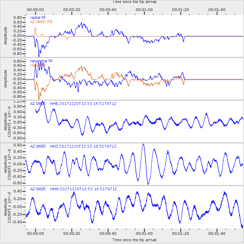
SMER AZ.SMER - Earthquake Result Viewer
*The percent match for this event was below the threshold and hence no stack was calculated.
| Earthquake location: |
Southeast Of Shikoku, Japan |
| Earthquake latitude/longitude: |
30.6/132.1 |
| Earthquake time(UTC): |
2017/12/20 (354) 13:40:54 GMT |
| Earthquake Depth: |
10 km |
| Earthquake Magnitude: |
5.5 Mww |
| Earthquake Catalog/Contributor: |
NEIC PDE/us |
|
| Network: |
AZ ANZA Regional Network |
| Station: |
SMER AZ.SMER |
| Lat/Lon: |
33.46 N/117.17 W |
| Elevation: |
355 m |
|
| Distance: |
88.7 deg |
| Az: |
51.436 deg |
| Baz: |
306.269 deg |
| Ray Param: |
$rayparam |
*The percent match for this event was below the threshold and hence was not used in the summary stack. |
|
| Radial Match: |
66.65192 % |
| Radial Bump: |
400 |
| Transverse Match: |
63.351814 % |
| Transverse Bump: |
400 |
| SOD ConfigId: |
13570011 |
| Insert Time: |
2019-04-29 11:16:51.068 +0000 |
| GWidth: |
2.5 |
| Max Bumps: |
400 |
| Tol: |
0.001 |
|
Signal To Noise
| Channel | StoN | STA | LTA |
| AZ:SMER: :HHZ:20171220T13:53:16.527971Z | 0.6138161 | 1.3342631E-7 | 2.1737182E-7 |
| AZ:SMER: :HHN:20171220T13:53:16.527971Z | 0.627949 | 1.0372035E-7 | 1.6517322E-7 |
| AZ:SMER: :HHE:20171220T13:53:16.527971Z | 1.310897 | 5.354365E-7 | 4.0845052E-7 |
| Arrivals |
| Ps | |
| PpPs | |
| PsPs/PpSs | |


