You are here: Home > Network List > CI - Caltech Regional Seismic Network Stations List
> Station MPP McPhearson Peak > Earthquake Result Viewer
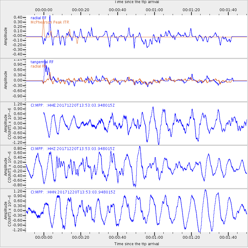
MPP McPhearson Peak - Earthquake Result Viewer
*The percent match for this event was below the threshold and hence no stack was calculated.
| Earthquake location: |
Southeast Of Shikoku, Japan |
| Earthquake latitude/longitude: |
30.6/132.1 |
| Earthquake time(UTC): |
2017/12/20 (354) 13:40:54 GMT |
| Earthquake Depth: |
10 km |
| Earthquake Magnitude: |
5.5 Mww |
| Earthquake Catalog/Contributor: |
NEIC PDE/us |
|
| Network: |
CI Caltech Regional Seismic Network |
| Station: |
MPP McPhearson Peak |
| Lat/Lon: |
34.89 N/119.81 W |
| Elevation: |
1739 m |
|
| Distance: |
86.1 deg |
| Az: |
51.548 deg |
| Baz: |
304.796 deg |
| Ray Param: |
$rayparam |
*The percent match for this event was below the threshold and hence was not used in the summary stack. |
|
| Radial Match: |
69.13468 % |
| Radial Bump: |
400 |
| Transverse Match: |
62.922356 % |
| Transverse Bump: |
400 |
| SOD ConfigId: |
13570011 |
| Insert Time: |
2019-04-29 11:17:28.034 +0000 |
| GWidth: |
2.5 |
| Max Bumps: |
400 |
| Tol: |
0.001 |
|
Signal To Noise
| Channel | StoN | STA | LTA |
| CI:MPP: :HHZ:20171220T13:53:03.948015Z | 1.3993255 | 4.5517024E-7 | 3.252783E-7 |
| CI:MPP: :HHN:20171220T13:53:03.948015Z | 1.8590603 | 5.3081726E-7 | 2.855299E-7 |
| CI:MPP: :HHE:20171220T13:53:03.948015Z | 0.7568644 | 2.5765607E-7 | 3.4042563E-7 |
| Arrivals |
| Ps | |
| PpPs | |
| PsPs/PpSs | |


