You are here: Home > Network List > TA - USArray Transportable Network (new EarthScope stations) Stations List
> Station A36M Sachs Harbour, NT, CAN > Earthquake Result Viewer
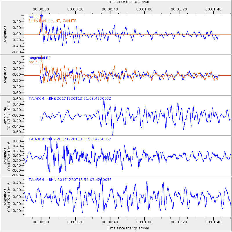
A36M Sachs Harbour, NT, CAN - Earthquake Result Viewer
*The percent match for this event was below the threshold and hence no stack was calculated.
| Earthquake location: |
Southeast Of Shikoku, Japan |
| Earthquake latitude/longitude: |
30.6/132.1 |
| Earthquake time(UTC): |
2017/12/20 (354) 13:40:54 GMT |
| Earthquake Depth: |
10 km |
| Earthquake Magnitude: |
5.5 Mww |
| Earthquake Catalog/Contributor: |
NEIC PDE/us |
|
| Network: |
TA USArray Transportable Network (new EarthScope stations) |
| Station: |
A36M Sachs Harbour, NT, CAN |
| Lat/Lon: |
71.99 N/125.25 W |
| Elevation: |
32 m |
|
| Distance: |
65.0 deg |
| Az: |
19.569 deg |
| Baz: |
291.872 deg |
| Ray Param: |
$rayparam |
*The percent match for this event was below the threshold and hence was not used in the summary stack. |
|
| Radial Match: |
77.40296 % |
| Radial Bump: |
400 |
| Transverse Match: |
66.6507 % |
| Transverse Bump: |
400 |
| SOD ConfigId: |
13570011 |
| Insert Time: |
2019-04-29 11:20:41.583 +0000 |
| GWidth: |
2.5 |
| Max Bumps: |
400 |
| Tol: |
0.001 |
|
Signal To Noise
| Channel | StoN | STA | LTA |
| TA:A36M: :BHZ:20171220T13:51:03.425005Z | 2.3466167 | 2.4297972E-7 | 1.035447E-7 |
| TA:A36M: :BHN:20171220T13:51:03.425005Z | 0.78332335 | 1.192379E-7 | 1.5222054E-7 |
| TA:A36M: :BHE:20171220T13:51:03.425005Z | 1.4918097 | 1.3697425E-7 | 9.181751E-8 |
| Arrivals |
| Ps | |
| PpPs | |
| PsPs/PpSs | |


