You are here: Home > Network List > TA - USArray Transportable Network (new EarthScope stations) Stations List
> Station B22K Teshekpuk Lake, AK, USA > Earthquake Result Viewer
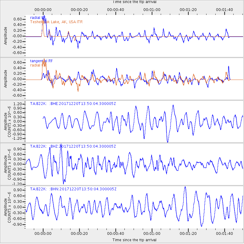
B22K Teshekpuk Lake, AK, USA - Earthquake Result Viewer
*The percent match for this event was below the threshold and hence no stack was calculated.
| Earthquake location: |
Southeast Of Shikoku, Japan |
| Earthquake latitude/longitude: |
30.6/132.1 |
| Earthquake time(UTC): |
2017/12/20 (354) 13:40:54 GMT |
| Earthquake Depth: |
10 km |
| Earthquake Magnitude: |
5.5 Mww |
| Earthquake Catalog/Contributor: |
NEIC PDE/us |
|
| Network: |
TA USArray Transportable Network (new EarthScope stations) |
| Station: |
B22K Teshekpuk Lake, AK, USA |
| Lat/Lon: |
70.34 N/153.42 W |
| Elevation: |
50 m |
|
| Distance: |
56.3 deg |
| Az: |
23.082 deg |
| Baz: |
266.896 deg |
| Ray Param: |
$rayparam |
*The percent match for this event was below the threshold and hence was not used in the summary stack. |
|
| Radial Match: |
74.32588 % |
| Radial Bump: |
400 |
| Transverse Match: |
64.40509 % |
| Transverse Bump: |
400 |
| SOD ConfigId: |
13570011 |
| Insert Time: |
2019-04-29 11:20:42.808 +0000 |
| GWidth: |
2.5 |
| Max Bumps: |
400 |
| Tol: |
0.001 |
|
Signal To Noise
| Channel | StoN | STA | LTA |
| TA:B22K: :BHZ:20171220T13:50:04.300005Z | 2.0973232 | 5.726143E-7 | 2.7302147E-7 |
| TA:B22K: :BHN:20171220T13:50:04.300005Z | 1.1194143 | 3.3879223E-7 | 3.0265133E-7 |
| TA:B22K: :BHE:20171220T13:50:04.300005Z | 1.2969407 | 4.325199E-7 | 3.334924E-7 |
| Arrivals |
| Ps | |
| PpPs | |
| PsPs/PpSs | |


