You are here: Home > Network List > CN - Canadian National Seismograph Network Stations List
> Station INK INUVIK, NT > Earthquake Result Viewer
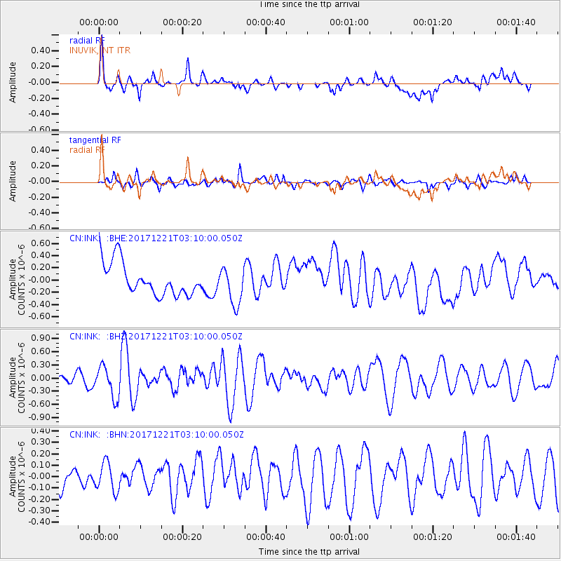
INK INUVIK, NT - Earthquake Result Viewer
*The percent match for this event was below the threshold and hence no stack was calculated.
| Earthquake location: |
Southeast Of Honshu, Japan |
| Earthquake latitude/longitude: |
29.3/142.7 |
| Earthquake time(UTC): |
2017/12/21 (355) 03:00:19 GMT |
| Earthquake Depth: |
16 km |
| Earthquake Magnitude: |
5.7 Mww |
| Earthquake Catalog/Contributor: |
NEIC PDE/us |
|
| Network: |
CN Canadian National Seismograph Network |
| Station: |
INK INUVIK, NT |
| Lat/Lon: |
68.31 N/133.53 W |
| Elevation: |
44 m |
|
| Distance: |
60.8 deg |
| Az: |
25.036 deg |
| Baz: |
276.094 deg |
| Ray Param: |
$rayparam |
*The percent match for this event was below the threshold and hence was not used in the summary stack. |
|
| Radial Match: |
50.50505 % |
| Radial Bump: |
400 |
| Transverse Match: |
47.728016 % |
| Transverse Bump: |
376 |
| SOD ConfigId: |
13570011 |
| Insert Time: |
2019-04-29 11:24:48.614 +0000 |
| GWidth: |
2.5 |
| Max Bumps: |
400 |
| Tol: |
0.001 |
|
Signal To Noise
| Channel | StoN | STA | LTA |
| CN:INK: :BHZ:20171221T03:10:00.050Z | 2.6672373 | 3.6583268E-7 | 1.371579E-7 |
| CN:INK: :BHN:20171221T03:10:00.050Z | 1.2874 | 1.2763284E-7 | 9.914001E-8 |
| CN:INK: :BHE:20171221T03:10:00.050Z | 1.156433 | 3.0847778E-7 | 2.667494E-7 |
| Arrivals |
| Ps | |
| PpPs | |
| PsPs/PpSs | |


