You are here: Home > Network List > TA - USArray Transportable Network (new EarthScope stations) Stations List
> Station E18K Tukpahlearik Creek, AK, USA > Earthquake Result Viewer
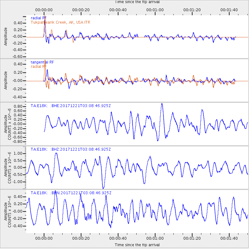
E18K Tukpahlearik Creek, AK, USA - Earthquake Result Viewer
*The percent match for this event was below the threshold and hence no stack was calculated.
| Earthquake location: |
Southeast Of Honshu, Japan |
| Earthquake latitude/longitude: |
29.3/142.7 |
| Earthquake time(UTC): |
2017/12/21 (355) 03:00:19 GMT |
| Earthquake Depth: |
16 km |
| Earthquake Magnitude: |
5.7 Mww |
| Earthquake Catalog/Contributor: |
NEIC PDE/us |
|
| Network: |
TA USArray Transportable Network (new EarthScope stations) |
| Station: |
E18K Tukpahlearik Creek, AK, USA |
| Lat/Lon: |
67.42 N/160.60 W |
| Elevation: |
297 m |
|
| Distance: |
50.6 deg |
| Az: |
24.667 deg |
| Baz: |
250.761 deg |
| Ray Param: |
$rayparam |
*The percent match for this event was below the threshold and hence was not used in the summary stack. |
|
| Radial Match: |
66.22936 % |
| Radial Bump: |
400 |
| Transverse Match: |
57.94291 % |
| Transverse Bump: |
379 |
| SOD ConfigId: |
13570011 |
| Insert Time: |
2019-04-29 11:27:57.955 +0000 |
| GWidth: |
2.5 |
| Max Bumps: |
400 |
| Tol: |
0.001 |
|
Signal To Noise
| Channel | StoN | STA | LTA |
| TA:E18K: :BHZ:20171221T03:08:46.925Z | 1.7099336 | 4.6378554E-7 | 2.7123014E-7 |
| TA:E18K: :BHN:20171221T03:08:46.925Z | 0.8696234 | 1.9169461E-7 | 2.2043405E-7 |
| TA:E18K: :BHE:20171221T03:08:46.925Z | 1.1508514 | 2.1437772E-7 | 1.8627752E-7 |
| Arrivals |
| Ps | |
| PpPs | |
| PsPs/PpSs | |


