You are here: Home > Network List > TA - USArray Transportable Network (new EarthScope stations) Stations List
> Station F31M Tsiigehtchic, NWT, CAN > Earthquake Result Viewer
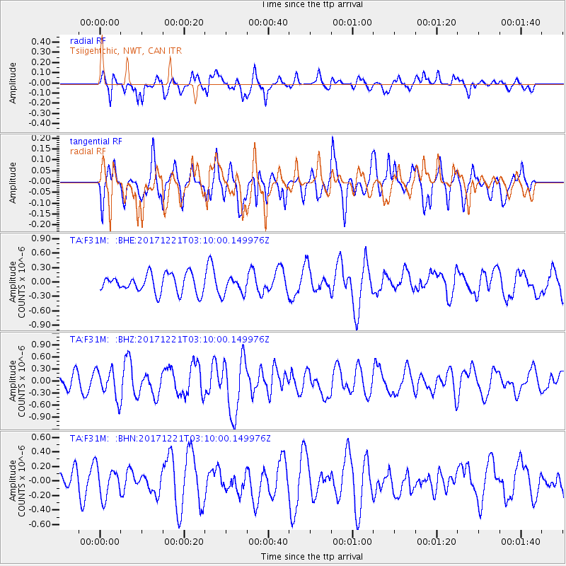
F31M Tsiigehtchic, NWT, CAN - Earthquake Result Viewer
*The percent match for this event was below the threshold and hence no stack was calculated.
| Earthquake location: |
Southeast Of Honshu, Japan |
| Earthquake latitude/longitude: |
29.3/142.7 |
| Earthquake time(UTC): |
2017/12/21 (355) 03:00:19 GMT |
| Earthquake Depth: |
16 km |
| Earthquake Magnitude: |
5.7 Mww |
| Earthquake Catalog/Contributor: |
NEIC PDE/us |
|
| Network: |
TA USArray Transportable Network (new EarthScope stations) |
| Station: |
F31M Tsiigehtchic, NWT, CAN |
| Lat/Lon: |
67.44 N/133.74 W |
| Elevation: |
56 m |
|
| Distance: |
60.9 deg |
| Az: |
26.036 deg |
| Baz: |
276.38 deg |
| Ray Param: |
$rayparam |
*The percent match for this event was below the threshold and hence was not used in the summary stack. |
|
| Radial Match: |
47.168564 % |
| Radial Bump: |
400 |
| Transverse Match: |
41.46858 % |
| Transverse Bump: |
400 |
| SOD ConfigId: |
13570011 |
| Insert Time: |
2019-04-29 11:28:04.586 +0000 |
| GWidth: |
2.5 |
| Max Bumps: |
400 |
| Tol: |
0.001 |
|
Signal To Noise
| Channel | StoN | STA | LTA |
| TA:F31M: :BHZ:20171221T03:10:00.149976Z | 2.111394 | 3.626048E-7 | 1.7173716E-7 |
| TA:F31M: :BHN:20171221T03:10:00.149976Z | 1.5638765 | 2.0217242E-7 | 1.2927646E-7 |
| TA:F31M: :BHE:20171221T03:10:00.149976Z | 0.9819289 | 1.8814308E-7 | 1.9160561E-7 |
| Arrivals |
| Ps | |
| PpPs | |
| PsPs/PpSs | |


