You are here: Home > Network List > TA - USArray Transportable Network (new EarthScope stations) Stations List
> Station L29M Grand Valley Creek, YT, CAN > Earthquake Result Viewer
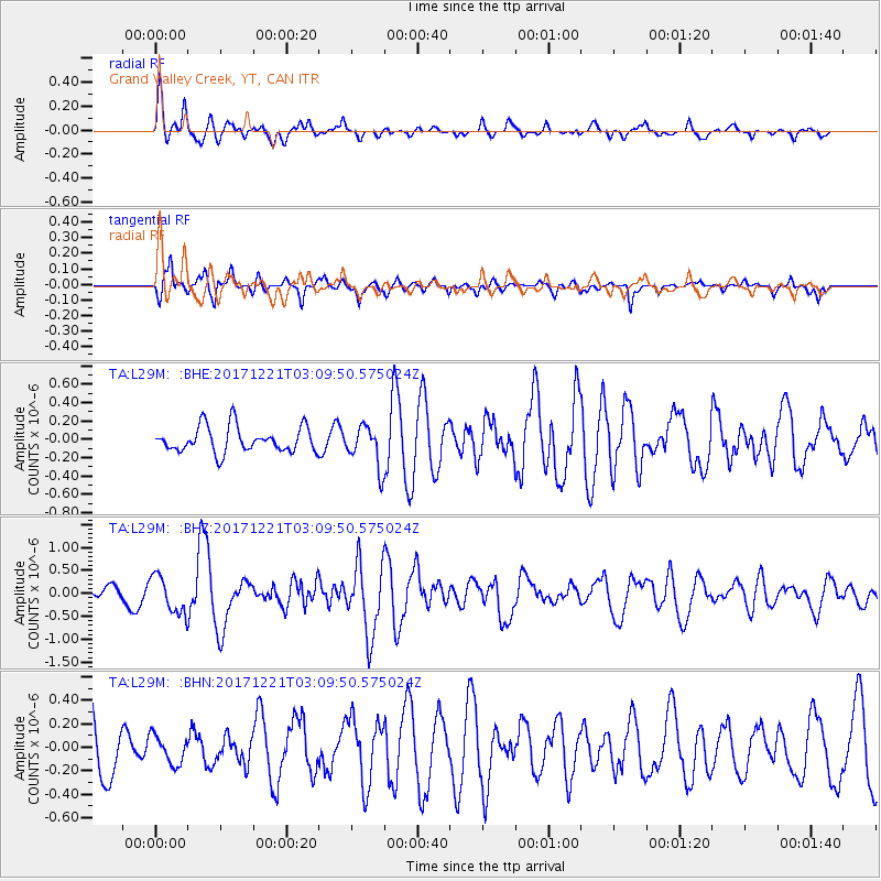
L29M Grand Valley Creek, YT, CAN - Earthquake Result Viewer
*The percent match for this event was below the threshold and hence no stack was calculated.
| Earthquake location: |
Southeast Of Honshu, Japan |
| Earthquake latitude/longitude: |
29.3/142.7 |
| Earthquake time(UTC): |
2017/12/21 (355) 03:00:19 GMT |
| Earthquake Depth: |
16 km |
| Earthquake Magnitude: |
5.7 Mww |
| Earthquake Catalog/Contributor: |
NEIC PDE/us |
|
| Network: |
TA USArray Transportable Network (new EarthScope stations) |
| Station: |
L29M Grand Valley Creek, YT, CAN |
| Lat/Lon: |
63.11 N/138.13 W |
| Elevation: |
918 m |
|
| Distance: |
59.5 deg |
| Az: |
31.235 deg |
| Baz: |
274.986 deg |
| Ray Param: |
$rayparam |
*The percent match for this event was below the threshold and hence was not used in the summary stack. |
|
| Radial Match: |
76.88886 % |
| Radial Bump: |
400 |
| Transverse Match: |
54.935303 % |
| Transverse Bump: |
325 |
| SOD ConfigId: |
13570011 |
| Insert Time: |
2019-04-29 11:28:17.735 +0000 |
| GWidth: |
2.5 |
| Max Bumps: |
400 |
| Tol: |
0.001 |
|
Signal To Noise
| Channel | StoN | STA | LTA |
| TA:L29M: :BHZ:20171221T03:09:50.575024Z | 1.985625 | 4.1824944E-7 | 2.106387E-7 |
| TA:L29M: :BHN:20171221T03:09:50.575024Z | 0.6028098 | 1.193694E-7 | 1.9802168E-7 |
| TA:L29M: :BHE:20171221T03:09:50.575024Z | 1.1061037 | 1.537079E-7 | 1.3896339E-7 |
| Arrivals |
| Ps | |
| PpPs | |
| PsPs/PpSs | |


