You are here: Home > Network List > TJ - Tajikistan National Seismic Network Stations List
> Station GARM Garm, Tajikistan > Earthquake Result Viewer
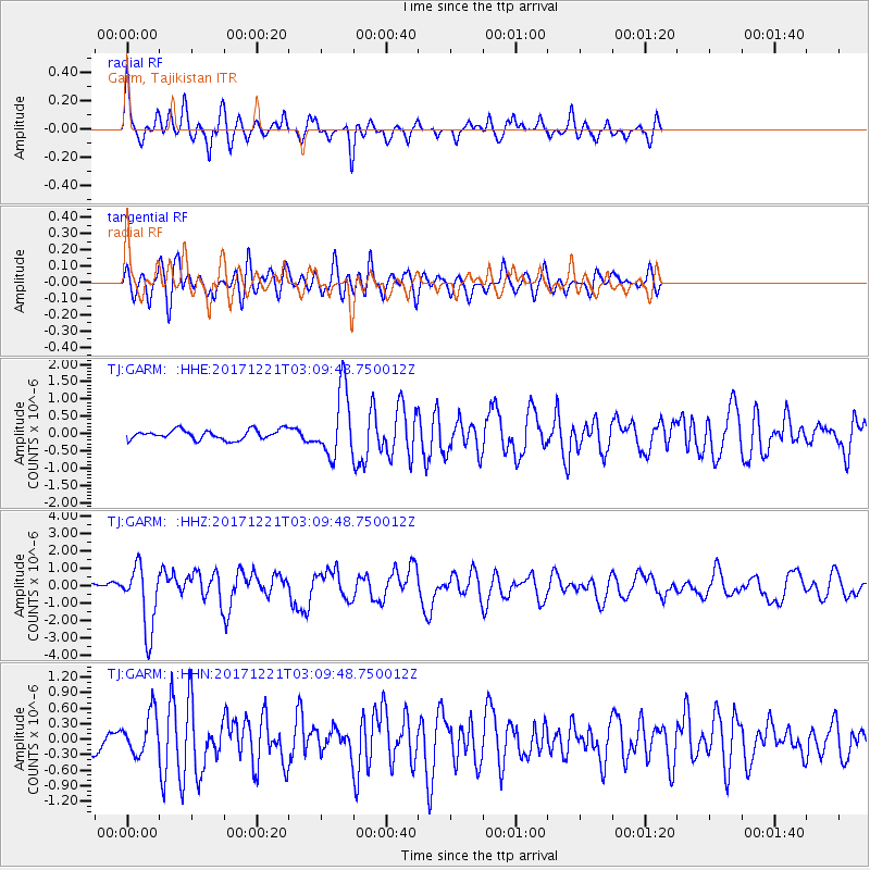
GARM Garm, Tajikistan - Earthquake Result Viewer
*The percent match for this event was below the threshold and hence no stack was calculated.
| Earthquake location: |
Southeast Of Honshu, Japan |
| Earthquake latitude/longitude: |
29.3/142.7 |
| Earthquake time(UTC): |
2017/12/21 (355) 03:00:19 GMT |
| Earthquake Depth: |
16 km |
| Earthquake Magnitude: |
5.7 Mww |
| Earthquake Catalog/Contributor: |
NEIC PDE/us |
|
| Network: |
TJ Tajikistan National Seismic Network |
| Station: |
GARM Garm, Tajikistan |
| Lat/Lon: |
39.00 N/70.32 E |
| Elevation: |
1305 m |
|
| Distance: |
59.3 deg |
| Az: |
300.235 deg |
| Baz: |
75.607 deg |
| Ray Param: |
$rayparam |
*The percent match for this event was below the threshold and hence was not used in the summary stack. |
|
| Radial Match: |
77.209045 % |
| Radial Bump: |
400 |
| Transverse Match: |
73.65035 % |
| Transverse Bump: |
400 |
| SOD ConfigId: |
13570011 |
| Insert Time: |
2019-04-29 11:28:37.559 +0000 |
| GWidth: |
2.5 |
| Max Bumps: |
400 |
| Tol: |
0.001 |
|
Signal To Noise
| Channel | StoN | STA | LTA |
| TJ:GARM: :HHZ:20171221T03:09:48.750012Z | 8.695813 | 1.8527141E-6 | 2.1305817E-7 |
| TJ:GARM: :HHN:20171221T03:09:48.750012Z | 2.0713046 | 4.0055147E-7 | 1.9338125E-7 |
| TJ:GARM: :HHE:20171221T03:09:48.750012Z | 6.8026376 | 9.587452E-7 | 1.4093727E-7 |
| Arrivals |
| Ps | |
| PpPs | |
| PsPs/PpSs | |


