You are here: Home > Network List > TA - USArray Transportable Network (new EarthScope stations) Stations List
> Station L44A Lake County Forest Preserve, Grayslake, IL, USA > Earthquake Result Viewer
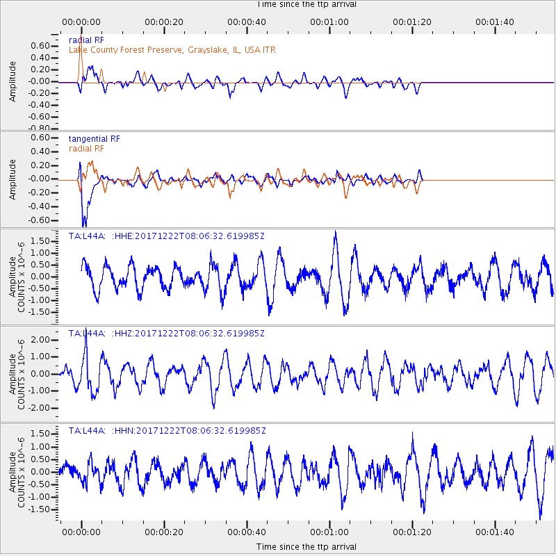
L44A Lake County Forest Preserve, Grayslake, IL, USA - Earthquake Result Viewer
*The percent match for this event was below the threshold and hence no stack was calculated.
| Earthquake location: |
Northern Yukon Territory, Canada |
| Earthquake latitude/longitude: |
65.5/-134.1 |
| Earthquake time(UTC): |
2017/12/22 (356) 08:00:13 GMT |
| Earthquake Depth: |
3.5 km |
| Earthquake Magnitude: |
5.0 Mww |
| Earthquake Catalog/Contributor: |
NEIC PDE/us |
|
| Network: |
TA USArray Transportable Network (new EarthScope stations) |
| Station: |
L44A Lake County Forest Preserve, Grayslake, IL, USA |
| Lat/Lon: |
42.18 N/87.91 W |
| Elevation: |
202 m |
|
| Distance: |
34.6 deg |
| Az: |
109.379 deg |
| Baz: |
328.021 deg |
| Ray Param: |
$rayparam |
*The percent match for this event was below the threshold and hence was not used in the summary stack. |
|
| Radial Match: |
63.094982 % |
| Radial Bump: |
400 |
| Transverse Match: |
88.25491 % |
| Transverse Bump: |
400 |
| SOD ConfigId: |
13570011 |
| Insert Time: |
2019-04-29 11:35:13.543 +0000 |
| GWidth: |
2.5 |
| Max Bumps: |
400 |
| Tol: |
0.001 |
|
Signal To Noise
| Channel | StoN | STA | LTA |
| TA:L44A: :HHZ:20171222T08:06:32.619985Z | 3.082281 | 1.0848372E-6 | 3.5195922E-7 |
| TA:L44A: :HHN:20171222T08:06:32.619985Z | 0.84511185 | 3.8184487E-7 | 4.5182762E-7 |
| TA:L44A: :HHE:20171222T08:06:32.619985Z | 1.3028255 | 6.0933286E-7 | 4.6770108E-7 |
| Arrivals |
| Ps | |
| PpPs | |
| PsPs/PpSs | |


