You are here: Home > Network List > US - United States National Seismic Network Stations List
> Station LKWY Lake (Yellowstone--Lake), Wyoming, USA > Earthquake Result Viewer
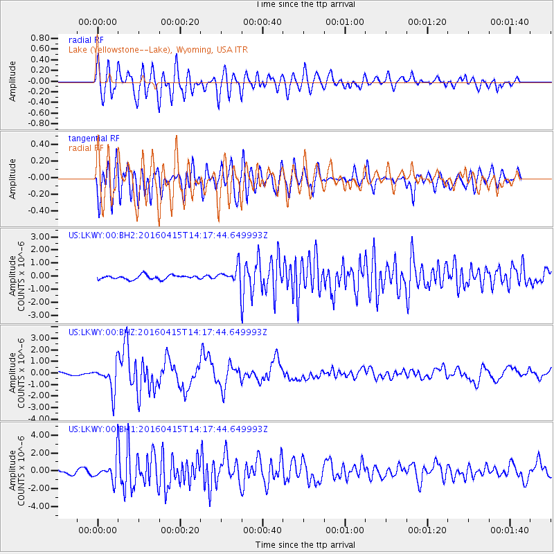
LKWY Lake (Yellowstone--Lake), Wyoming, USA - Earthquake Result Viewer
*The percent match for this event was below the threshold and hence no stack was calculated.
| Earthquake location: |
Off Coast Of Chiapas, Mexico |
| Earthquake latitude/longitude: |
13.5/-92.2 |
| Earthquake time(UTC): |
2016/04/15 (106) 14:11:29 GMT |
| Earthquake Depth: |
48 km |
| Earthquake Magnitude: |
6.2 MWP |
| Earthquake Catalog/Contributor: |
NEIC PDE/NEIC COMCAT |
|
| Network: |
US United States National Seismic Network |
| Station: |
LKWY Lake (Yellowstone--Lake), Wyoming, USA |
| Lat/Lon: |
44.57 N/110.40 W |
| Elevation: |
2424 m |
|
| Distance: |
34.7 deg |
| Az: |
336.847 deg |
| Baz: |
147.649 deg |
| Ray Param: |
$rayparam |
*The percent match for this event was below the threshold and hence was not used in the summary stack. |
|
| Radial Match: |
63.950363 % |
| Radial Bump: |
400 |
| Transverse Match: |
70.010376 % |
| Transverse Bump: |
400 |
| SOD ConfigId: |
1475611 |
| Insert Time: |
2016-04-29 14:25:55.409 +0000 |
| GWidth: |
2.5 |
| Max Bumps: |
400 |
| Tol: |
0.001 |
|
Signal To Noise
| Channel | StoN | STA | LTA |
| US:LKWY:00:BHZ:20160415T14:17:44.649993Z | 8.671707 | 1.221882E-6 | 1.4090445E-7 |
| US:LKWY:00:BH1:20160415T14:17:44.649993Z | 4.6796317 | 1.2891185E-6 | 2.7547435E-7 |
| US:LKWY:00:BH2:20160415T14:17:44.649993Z | 4.4342747 | 6.9809784E-7 | 1.5743225E-7 |
| Arrivals |
| Ps | |
| PpPs | |
| PsPs/PpSs | |


