You are here: Home > Network List > TA - USArray Transportable Network (new EarthScope stations) Stations List
> Station C16K Lisburne Hills, AK, USA > Earthquake Result Viewer
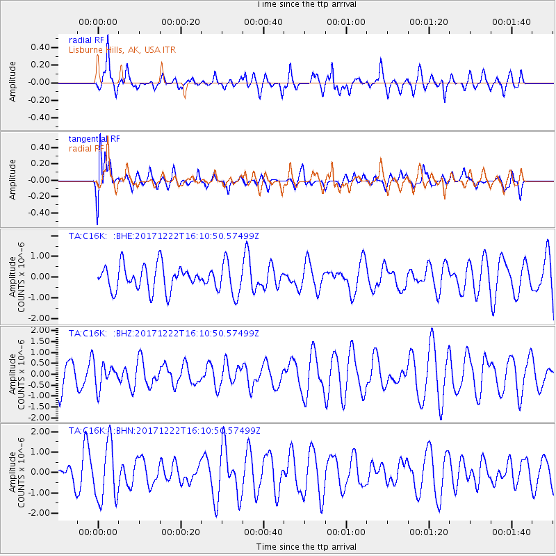
C16K Lisburne Hills, AK, USA - Earthquake Result Viewer
*The percent match for this event was below the threshold and hence no stack was calculated.
| Earthquake location: |
Andaman Islands, India Region |
| Earthquake latitude/longitude: |
10.0/93.0 |
| Earthquake time(UTC): |
2017/12/22 (356) 15:58:49 GMT |
| Earthquake Depth: |
34 km |
| Earthquake Magnitude: |
4.8 Mww |
| Earthquake Catalog/Contributor: |
NEIC PDE/us |
|
| Network: |
TA USArray Transportable Network (new EarthScope stations) |
| Station: |
C16K Lisburne Hills, AK, USA |
| Lat/Lon: |
68.27 N/165.34 W |
| Elevation: |
102 m |
|
| Distance: |
85.0 deg |
| Az: |
21.471 deg |
| Baz: |
284.467 deg |
| Ray Param: |
$rayparam |
*The percent match for this event was below the threshold and hence was not used in the summary stack. |
|
| Radial Match: |
56.72092 % |
| Radial Bump: |
400 |
| Transverse Match: |
49.71144 % |
| Transverse Bump: |
400 |
| SOD ConfigId: |
13570011 |
| Insert Time: |
2019-04-29 11:47:54.414 +0000 |
| GWidth: |
2.5 |
| Max Bumps: |
400 |
| Tol: |
0.001 |
|
Signal To Noise
| Channel | StoN | STA | LTA |
| TA:C16K: :BHZ:20171222T16:10:50.57499Z | 0.9163125 | 5.214464E-7 | 5.6907044E-7 |
| TA:C16K: :BHN:20171222T16:10:50.57499Z | 2.534282 | 1.4298884E-6 | 5.642183E-7 |
| TA:C16K: :BHE:20171222T16:10:50.57499Z | 1.4000014 | 8.3394616E-7 | 5.956752E-7 |
| Arrivals |
| Ps | |
| PpPs | |
| PsPs/PpSs | |


