You are here: Home > Network List > TA - USArray Transportable Network (new EarthScope stations) Stations List
> Station H31M Peel River, Yukon, CAN > Earthquake Result Viewer
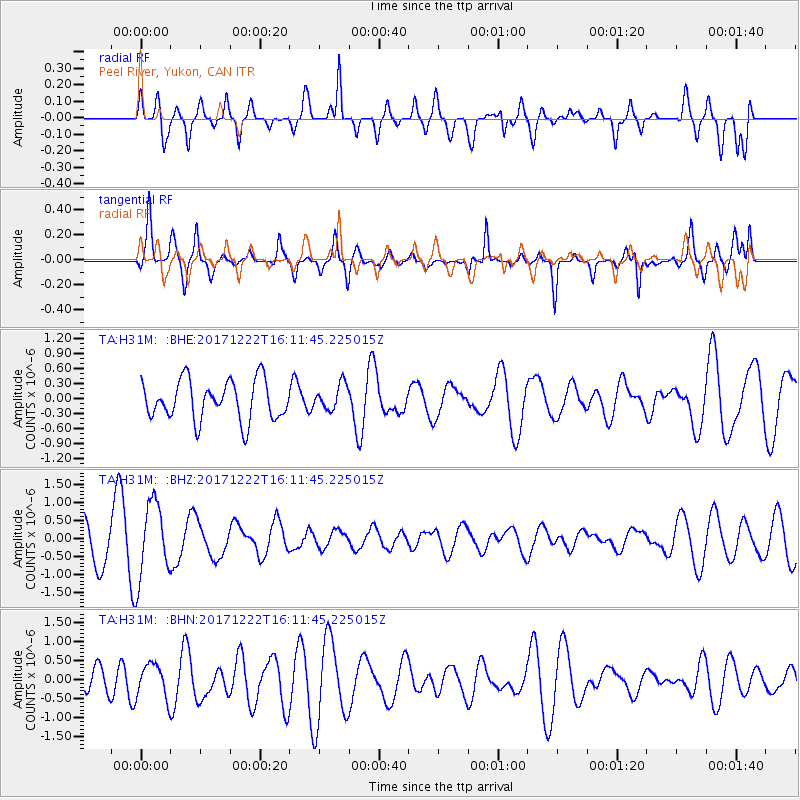
H31M Peel River, Yukon, CAN - Earthquake Result Viewer
*The percent match for this event was below the threshold and hence no stack was calculated.
| Earthquake location: |
Andaman Islands, India Region |
| Earthquake latitude/longitude: |
10.0/93.0 |
| Earthquake time(UTC): |
2017/12/22 (356) 15:58:49 GMT |
| Earthquake Depth: |
34 km |
| Earthquake Magnitude: |
4.8 Mww |
| Earthquake Catalog/Contributor: |
NEIC PDE/us |
|
| Network: |
TA USArray Transportable Network (new EarthScope stations) |
| Station: |
H31M Peel River, Yukon, CAN |
| Lat/Lon: |
65.81 N/134.34 W |
| Elevation: |
642 m |
|
| Distance: |
96.7 deg |
| Az: |
17.775 deg |
| Baz: |
313.152 deg |
| Ray Param: |
$rayparam |
*The percent match for this event was below the threshold and hence was not used in the summary stack. |
|
| Radial Match: |
53.79908 % |
| Radial Bump: |
400 |
| Transverse Match: |
62.591637 % |
| Transverse Bump: |
366 |
| SOD ConfigId: |
13570011 |
| Insert Time: |
2019-04-29 11:48:06.980 +0000 |
| GWidth: |
2.5 |
| Max Bumps: |
400 |
| Tol: |
0.001 |
|
Signal To Noise
| Channel | StoN | STA | LTA |
| TA:H31M: :BHZ:20171222T16:11:45.225015Z | 1.7541186 | 1.043976E-6 | 5.951571E-7 |
| TA:H31M: :BHN:20171222T16:11:45.225015Z | 1.1192015 | 4.4480788E-7 | 3.974332E-7 |
| TA:H31M: :BHE:20171222T16:11:45.225015Z | 0.64621073 | 2.5331985E-7 | 3.920081E-7 |
| Arrivals |
| Ps | |
| PpPs | |
| PsPs/PpSs | |


