You are here: Home > Network List > CI - Caltech Regional Seismic Network Stations List
> Station LRL Laurel Mtn Radio Fac, Ridgecrest, CA, USA > Earthquake Result Viewer
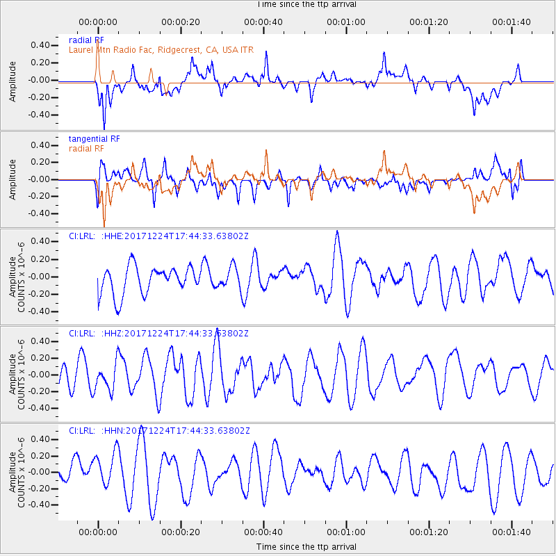
LRL Laurel Mtn Radio Fac, Ridgecrest, CA, USA - Earthquake Result Viewer
*The percent match for this event was below the threshold and hence no stack was calculated.
| Earthquake location: |
Samoa Islands Region |
| Earthquake latitude/longitude: |
-15.3/-172.9 |
| Earthquake time(UTC): |
2017/12/24 (358) 17:33:36 GMT |
| Earthquake Depth: |
10 km |
| Earthquake Magnitude: |
5.5 Mwb |
| Earthquake Catalog/Contributor: |
NEIC PDE/us |
|
| Network: |
CI Caltech Regional Seismic Network |
| Station: |
LRL Laurel Mtn Radio Fac, Ridgecrest, CA, USA |
| Lat/Lon: |
35.48 N/117.68 W |
| Elevation: |
1340 m |
|
| Distance: |
72.7 deg |
| Az: |
44.609 deg |
| Baz: |
236.115 deg |
| Ray Param: |
$rayparam |
*The percent match for this event was below the threshold and hence was not used in the summary stack. |
|
| Radial Match: |
71.02875 % |
| Radial Bump: |
400 |
| Transverse Match: |
56.21281 % |
| Transverse Bump: |
400 |
| SOD ConfigId: |
13570011 |
| Insert Time: |
2019-04-29 11:50:55.231 +0000 |
| GWidth: |
2.5 |
| Max Bumps: |
400 |
| Tol: |
0.001 |
|
Signal To Noise
| Channel | StoN | STA | LTA |
| CI:LRL: :HHZ:20171224T17:44:33.63802Z | 1.1652465 | 1.6155296E-7 | 1.3864275E-7 |
| CI:LRL: :HHN:20171224T17:44:33.63802Z | 2.0547597 | 2.6401705E-7 | 1.2849046E-7 |
| CI:LRL: :HHE:20171224T17:44:33.63802Z | 0.797532 | 1.2546165E-7 | 1.5731237E-7 |
| Arrivals |
| Ps | |
| PpPs | |
| PsPs/PpSs | |


