You are here: Home > Network List > AV - Alaska Volcano Observatory Stations List
> Station MAPS Pakushin Southeast, Makushin Volcano, Alaska > Earthquake Result Viewer
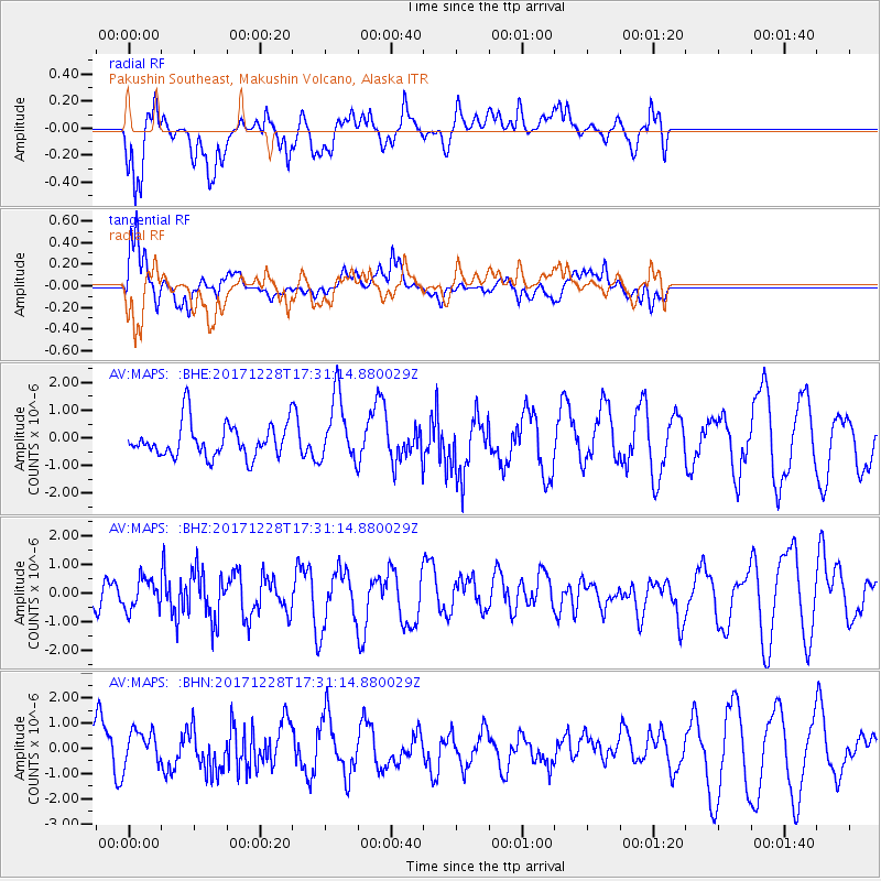
MAPS Pakushin Southeast, Makushin Volcano, Alaska - Earthquake Result Viewer
*The percent match for this event was below the threshold and hence no stack was calculated.
| Earthquake location: |
Talaud Islands, Indonesia |
| Earthquake latitude/longitude: |
4.1/126.8 |
| Earthquake time(UTC): |
2017/12/28 (362) 17:20:19 GMT |
| Earthquake Depth: |
24 km |
| Earthquake Magnitude: |
5.7 Mww |
| Earthquake Catalog/Contributor: |
NEIC PDE/us |
|
| Network: |
AV Alaska Volcano Observatory |
| Station: |
MAPS Pakushin Southeast, Makushin Volcano, Alaska |
| Lat/Lon: |
53.81 N/166.94 W |
| Elevation: |
333 m |
|
| Distance: |
72.8 deg |
| Az: |
34.626 deg |
| Baz: |
252.879 deg |
| Ray Param: |
$rayparam |
*The percent match for this event was below the threshold and hence was not used in the summary stack. |
|
| Radial Match: |
69.329414 % |
| Radial Bump: |
400 |
| Transverse Match: |
74.56909 % |
| Transverse Bump: |
400 |
| SOD ConfigId: |
13570011 |
| Insert Time: |
2019-04-29 12:08:32.090 +0000 |
| GWidth: |
2.5 |
| Max Bumps: |
400 |
| Tol: |
0.001 |
|
Signal To Noise
| Channel | StoN | STA | LTA |
| AV:MAPS: :BHZ:20171228T17:31:14.880029Z | 0.75987494 | 5.297655E-7 | 6.971746E-7 |
| AV:MAPS: :BHN:20171228T17:31:14.880029Z | 0.7236852 | 7.0256584E-7 | 9.708169E-7 |
| AV:MAPS: :BHE:20171228T17:31:14.880029Z | 1.967938 | 1.1934234E-6 | 6.064334E-7 |
| Arrivals |
| Ps | |
| PpPs | |
| PsPs/PpSs | |


