You are here: Home > Network List > TA - USArray Transportable Network (new EarthScope stations) Stations List
> Station 428A Kincaid Ranch, Fort Stockton, TX, USA > Earthquake Result Viewer
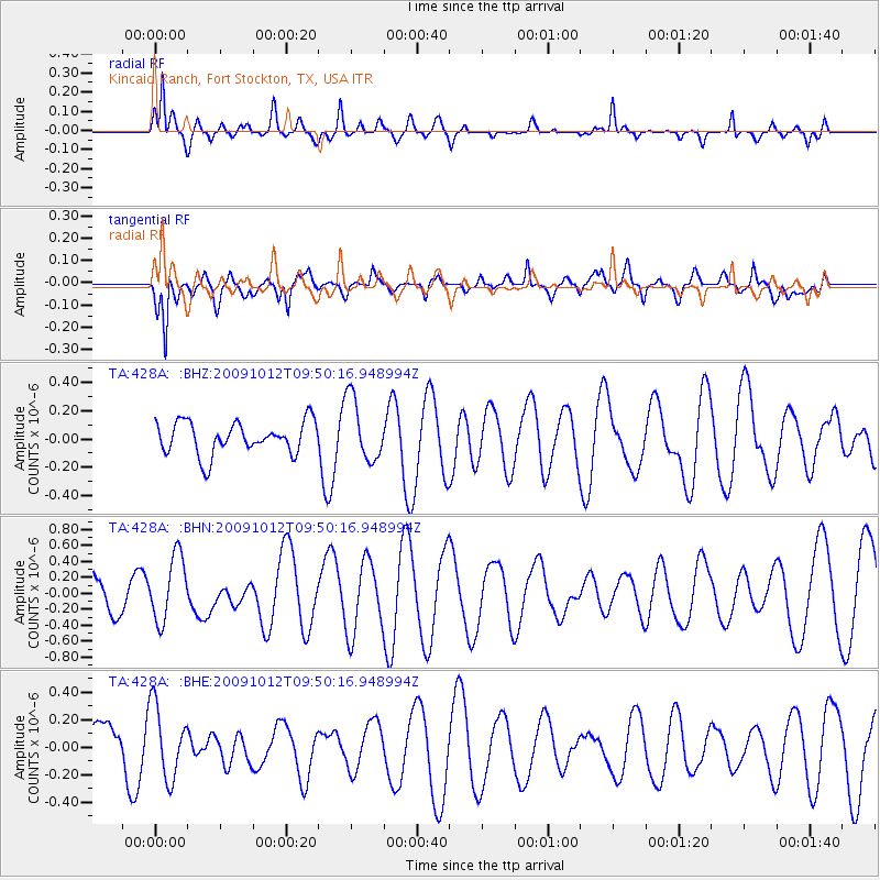
428A Kincaid Ranch, Fort Stockton, TX, USA - Earthquake Result Viewer
*The percent match for this event was below the threshold and hence no stack was calculated.
| Earthquake location: |
Santa Cruz Islands |
| Earthquake latitude/longitude: |
-12.4/166.5 |
| Earthquake time(UTC): |
2009/10/12 (285) 09:37:21 GMT |
| Earthquake Depth: |
42 km |
| Earthquake Magnitude: |
5.9 MB, 5.9 MS, 6.2 MW, 6.2 MW |
| Earthquake Catalog/Contributor: |
WHDF/NEIC |
|
| Network: |
TA USArray Transportable Network (new EarthScope stations) |
| Station: |
428A Kincaid Ranch, Fort Stockton, TX, USA |
| Lat/Lon: |
30.73 N/102.68 W |
| Elevation: |
982 m |
|
| Distance: |
96.9 deg |
| Az: |
60.153 deg |
| Baz: |
259.738 deg |
| Ray Param: |
$rayparam |
*The percent match for this event was below the threshold and hence was not used in the summary stack. |
|
| Radial Match: |
55.346745 % |
| Radial Bump: |
369 |
| Transverse Match: |
64.00499 % |
| Transverse Bump: |
392 |
| SOD ConfigId: |
2622 |
| Insert Time: |
2010-03-06 07:39:46.339 +0000 |
| GWidth: |
2.5 |
| Max Bumps: |
400 |
| Tol: |
0.001 |
|
Signal To Noise
| Channel | StoN | STA | LTA |
| TA:428A: :BHN:20091012T09:50:16.948994Z | 1.860025 | 4.0808965E-7 | 2.1940008E-7 |
| TA:428A: :BHE:20091012T09:50:16.948994Z | 1.5291287 | 2.645311E-7 | 1.7299466E-7 |
| TA:428A: :BHZ:20091012T09:50:16.948994Z | 1.9599408 | 2.2331524E-7 | 1.1393979E-7 |
| Arrivals |
| Ps | |
| PpPs | |
| PsPs/PpSs | |


