You are here: Home > Network List > TA - USArray Transportable Network (new EarthScope stations) Stations List
> Station B18K Kokolik River, AK, USA > Earthquake Result Viewer
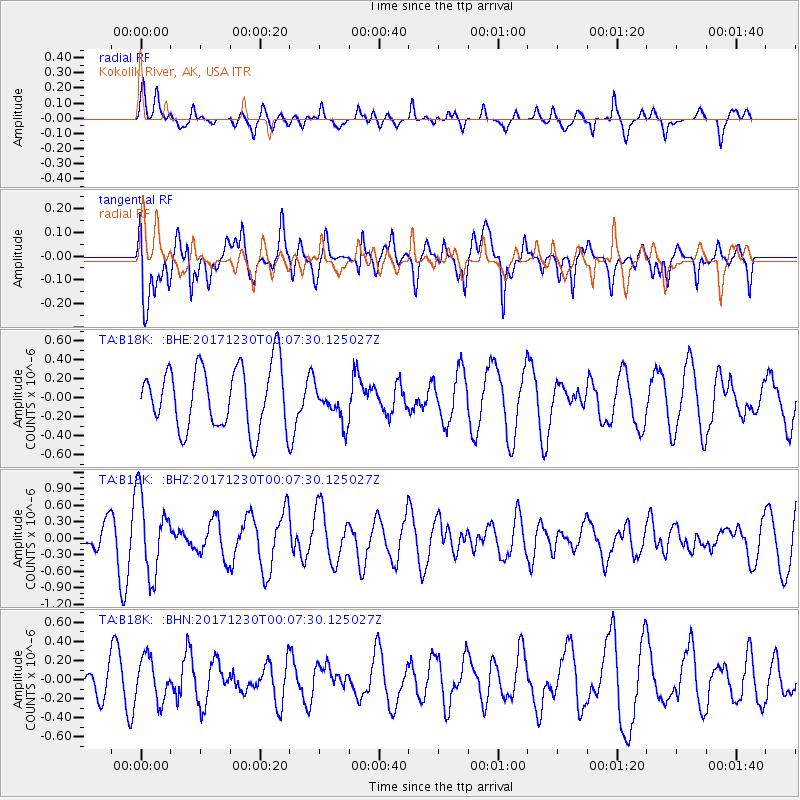
B18K Kokolik River, AK, USA - Earthquake Result Viewer
*The percent match for this event was below the threshold and hence no stack was calculated.
| Earthquake location: |
New Britain Region, P.N.G. |
| Earthquake latitude/longitude: |
-5.4/150.8 |
| Earthquake time(UTC): |
2017/12/29 (363) 23:55:54 GMT |
| Earthquake Depth: |
90 km |
| Earthquake Magnitude: |
5.7 Mww |
| Earthquake Catalog/Contributor: |
NEIC PDE/us |
|
| Network: |
TA USArray Transportable Network (new EarthScope stations) |
| Station: |
B18K Kokolik River, AK, USA |
| Lat/Lon: |
69.36 N/161.80 W |
| Elevation: |
222 m |
|
| Distance: |
81.3 deg |
| Az: |
15.294 deg |
| Baz: |
227.796 deg |
| Ray Param: |
$rayparam |
*The percent match for this event was below the threshold and hence was not used in the summary stack. |
|
| Radial Match: |
48.55409 % |
| Radial Bump: |
400 |
| Transverse Match: |
52.130283 % |
| Transverse Bump: |
400 |
| SOD ConfigId: |
13570011 |
| Insert Time: |
2019-04-29 12:19:51.852 +0000 |
| GWidth: |
2.5 |
| Max Bumps: |
400 |
| Tol: |
0.001 |
|
Signal To Noise
| Channel | StoN | STA | LTA |
| TA:B18K: :BHZ:20171230T00:07:30.125027Z | 2.7337015 | 7.136088E-7 | 2.6104124E-7 |
| TA:B18K: :BHN:20171230T00:07:30.125027Z | 0.79821396 | 2.2432819E-7 | 2.8103767E-7 |
| TA:B18K: :BHE:20171230T00:07:30.125027Z | 0.5908342 | 1.9349565E-7 | 3.2749568E-7 |
| Arrivals |
| Ps | |
| PpPs | |
| PsPs/PpSs | |


