You are here: Home > Network List > AZ - ANZA Regional Network Stations List
> Station SMER AZ.SMER > Earthquake Result Viewer
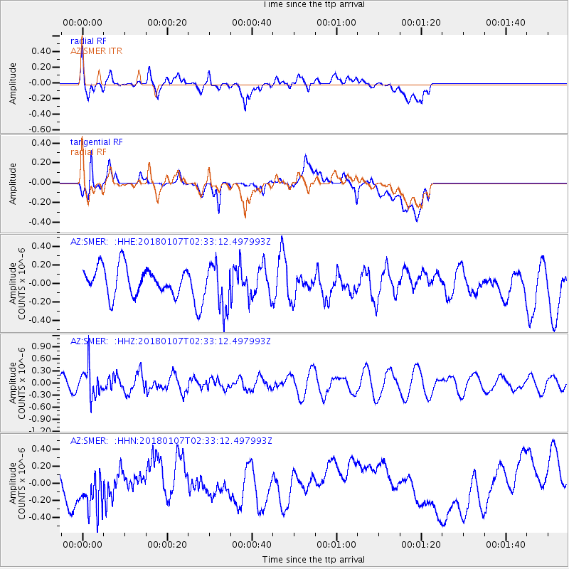
SMER AZ.SMER - Earthquake Result Viewer
*The percent match for this event was below the threshold and hence no stack was calculated.
| Earthquake location: |
Komandorskiye Ostrova Region |
| Earthquake latitude/longitude: |
55.1/165.7 |
| Earthquake time(UTC): |
2018/01/07 (007) 02:24:06 GMT |
| Earthquake Depth: |
35 km |
| Earthquake Magnitude: |
5.7 mb |
| Earthquake Catalog/Contributor: |
NEIC PDE/us |
|
| Network: |
AZ ANZA Regional Network |
| Station: |
SMER AZ.SMER |
| Lat/Lon: |
33.46 N/117.17 W |
| Elevation: |
355 m |
|
| Distance: |
56.2 deg |
| Az: |
78.676 deg |
| Baz: |
317.577 deg |
| Ray Param: |
$rayparam |
*The percent match for this event was below the threshold and hence was not used in the summary stack. |
|
| Radial Match: |
39.50533 % |
| Radial Bump: |
400 |
| Transverse Match: |
44.54709 % |
| Transverse Bump: |
400 |
| SOD ConfigId: |
13570011 |
| Insert Time: |
2019-04-29 12:34:18.976 +0000 |
| GWidth: |
2.5 |
| Max Bumps: |
400 |
| Tol: |
0.001 |
|
Signal To Noise
| Channel | StoN | STA | LTA |
| AZ:SMER: :HHZ:20180107T02:33:12.497993Z | 2.5716016 | 3.6545947E-7 | 1.4211356E-7 |
| AZ:SMER: :HHN:20180107T02:33:12.497993Z | 1.8785342 | 2.5545896E-7 | 1.3598846E-7 |
| AZ:SMER: :HHE:20180107T02:33:12.497993Z | 1.6868787 | 2.478651E-7 | 1.4693713E-7 |
| Arrivals |
| Ps | |
| PpPs | |
| PsPs/PpSs | |


